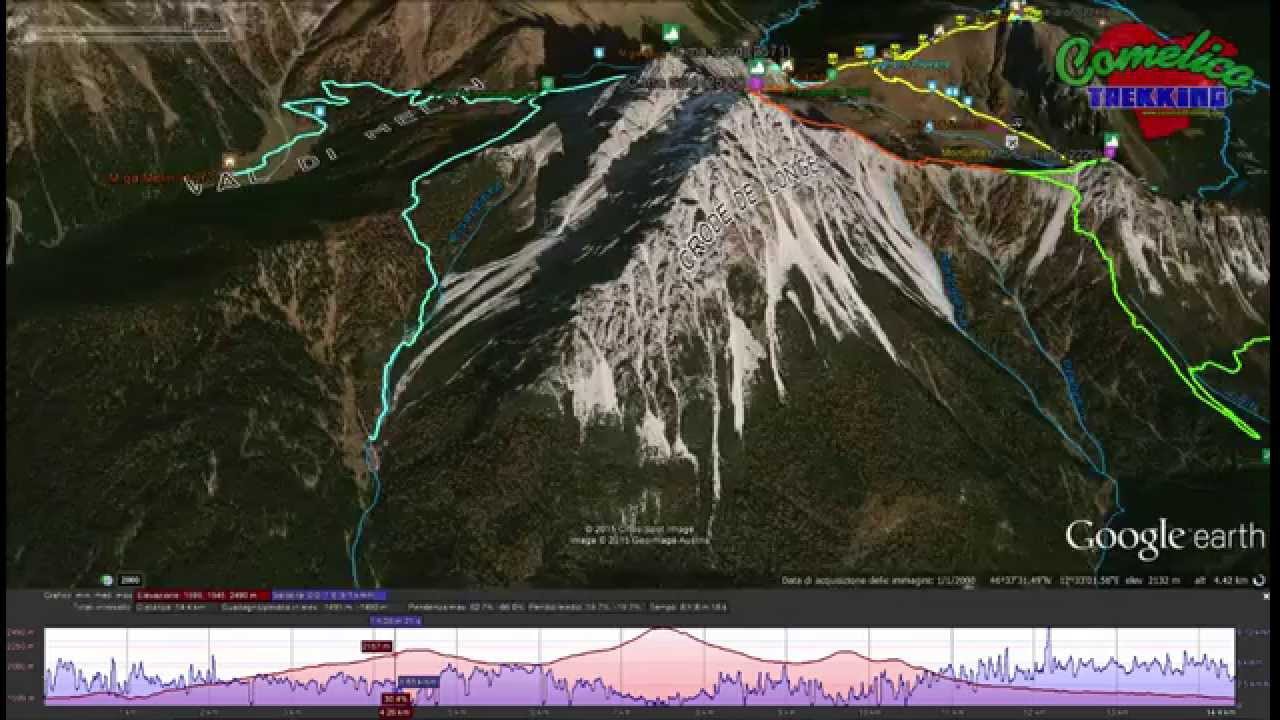
The 3 Tops of Vissada
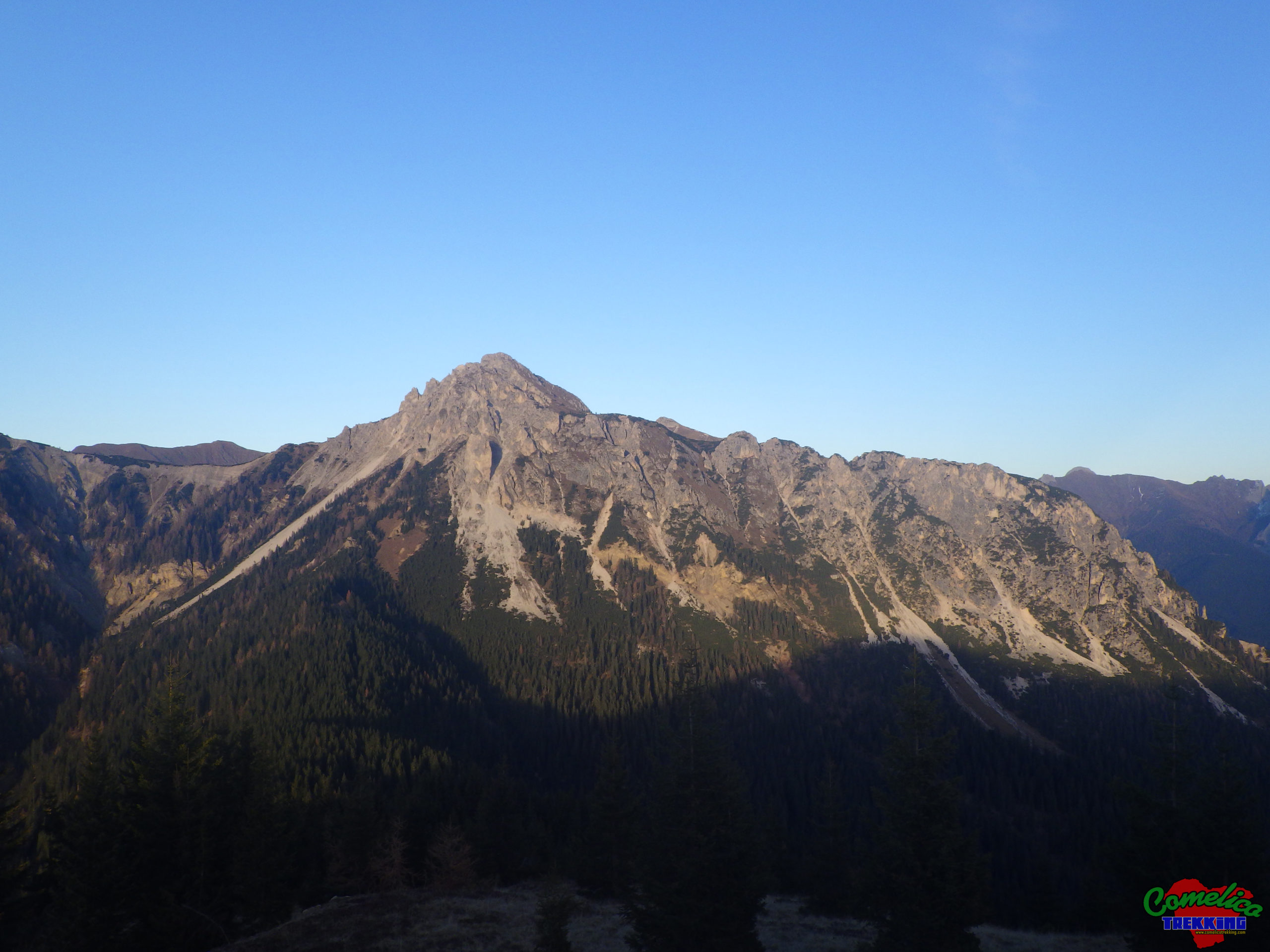
Val Vissada is located in the center of the Comelicense territory, it is formed and protected by three mountains that surround it. To the north The Crode dei Longerin, to the southwest Monte San Daniele and to the southeast Monte Schiaron.
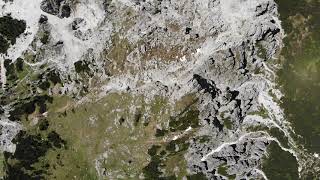
A splendid glacial valley that can be reached from the south, taking the path with CAI-169 trail from the F.la Zovo, from the north, starting from M.ga Londo following the CAI-167 trail or starting from M.ga Melin and following the CAI-165 path. It can also be reached from the west by starting the climb to the S.la dei Pradetti following the path marked CAI-165.
The area has many places to visit, as, in the past, it was the scene of military movements during the First World War. The typical buildings of the time now in ruins are still present: defensive trenches, retaining walls, caves, tunnels, loopholes and stakeouts. There are also more recent buildings that have seen it as a summer pasture for cattle and sheep.
The entire itinerary does not require any special mountaineering knowledge. It can be tackled with standard trekking equipment (boots, windbreaker, sunglasses and snowshoes) you will cover about 15 km in just over 8 hours with an elevation gain of almost 1300m and will see the achievement of all three peaks that dominate the valley. Alternatively, there is the Val Vissada Bivouac which allows you to stay overnight with a sleeping bag in tow.
The route follows a ring course, starting from the F.la Zovo, and following it will take the visitor, first to visit The Bombard and the Belvedere of Monte San Daniele, then, on the CAI-169 trail sign to the ascent; first at Schiaron, second at Longerin and ending on San Daniele. The return is along the path marked CAI-165 and then forest road with CAI-154 sign.
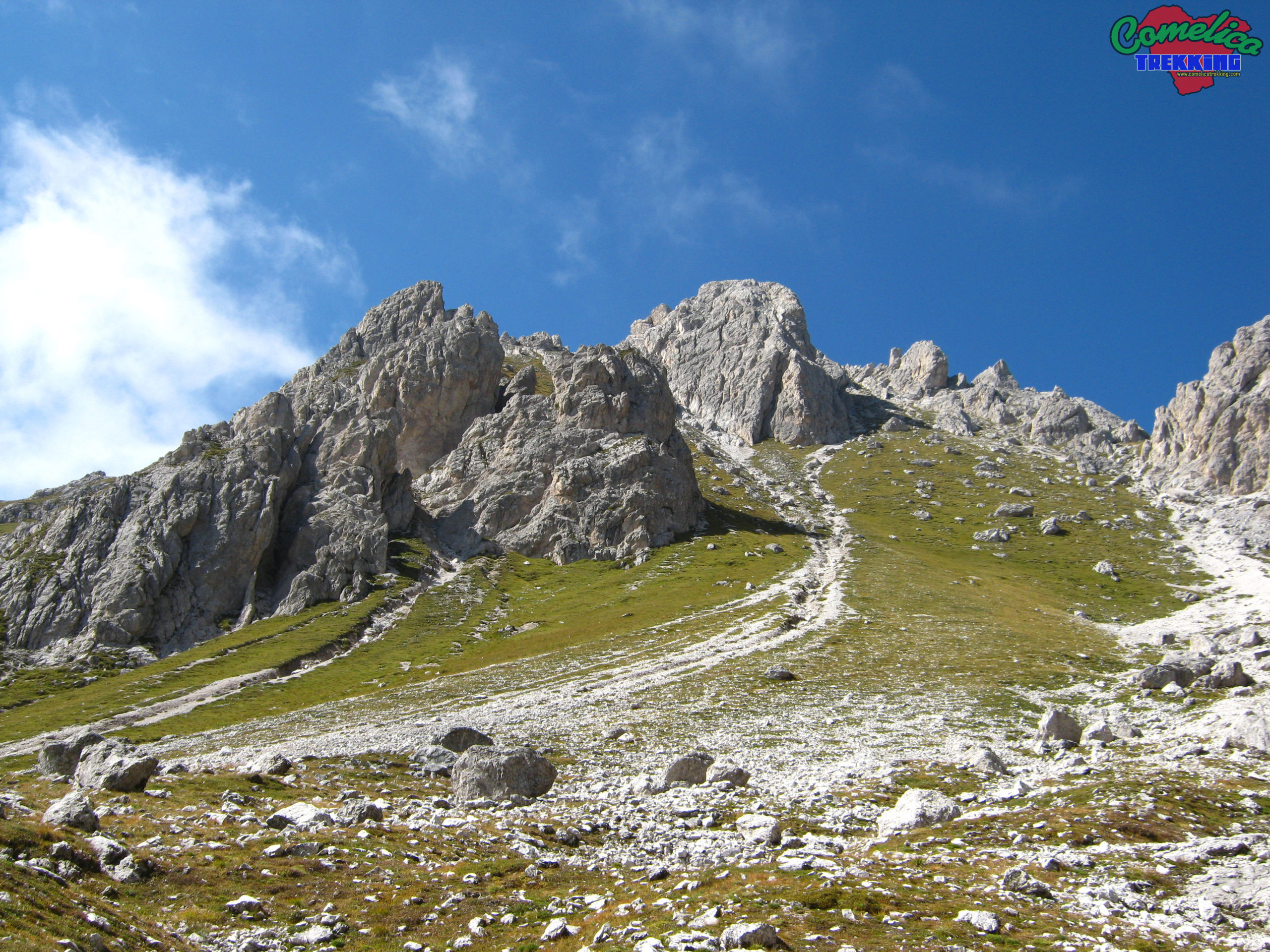
Once the car is parked at the F.la Zovo, we take the forest road to the left of the Refuge with CAI-154 trail signs heading westwards, towards Monte Zovo. After a few minutes on the gravel road, we meet a lay-by, we leave the road and take an unmarked path on the right that immediately climbs into the woods and turns left. After encountering the first trenches in the woods, climb again up to an altitude of 1660 m a.s.l. where the path turns north-east out of the woods. Now on gravel, even slightly exposed, we follow a military walkway of the First World War equipped with metal rope until we reach a tunnel that goes into the mountain for about fifteen meters.
Exiting from the other end, in a short time going up, we reach The Bombard pitch. Few remains of craged walls recall the installation of defensive mortars. Now you descend steeply to the junction for the belvedere which, to the south, leads to a raised platform from which you have a wonderful view of the Val Visdende.
Going back to the main path, descend a few more meters until you cross the CAI-169 trail marker, which climbs into the gorge carved by the Rio di Vissada, between Monte San Daniele and Monte Schiaron.
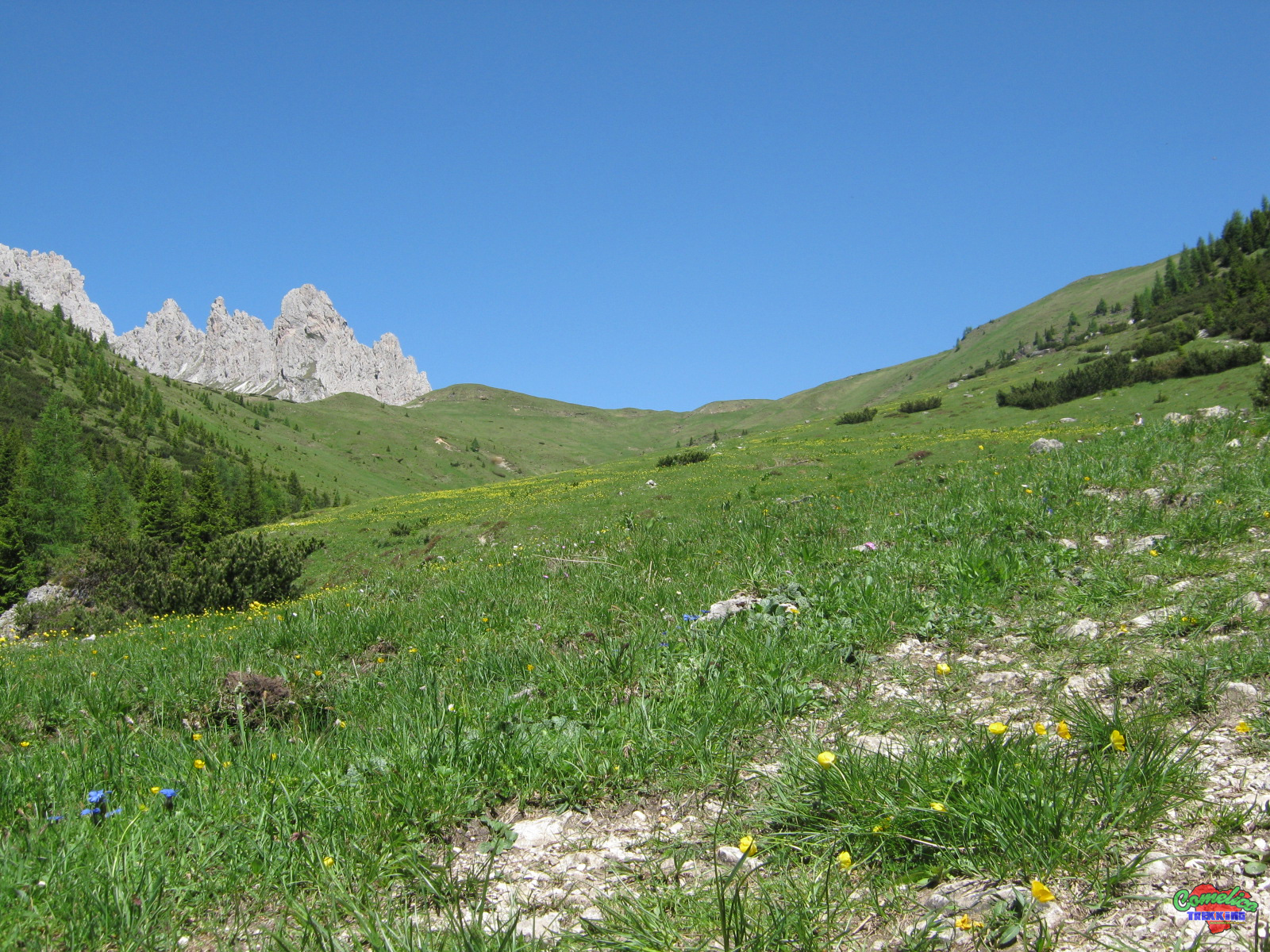
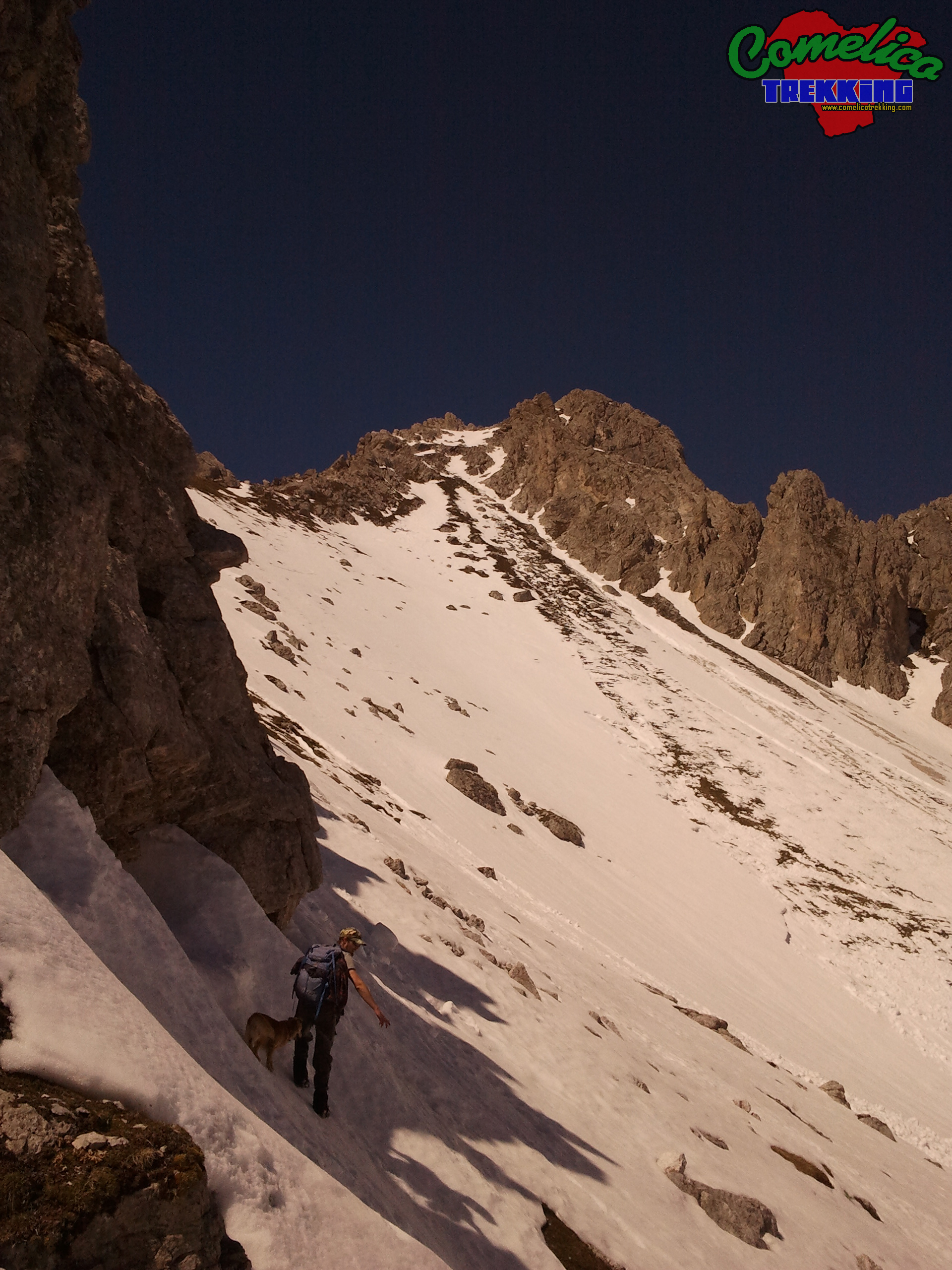
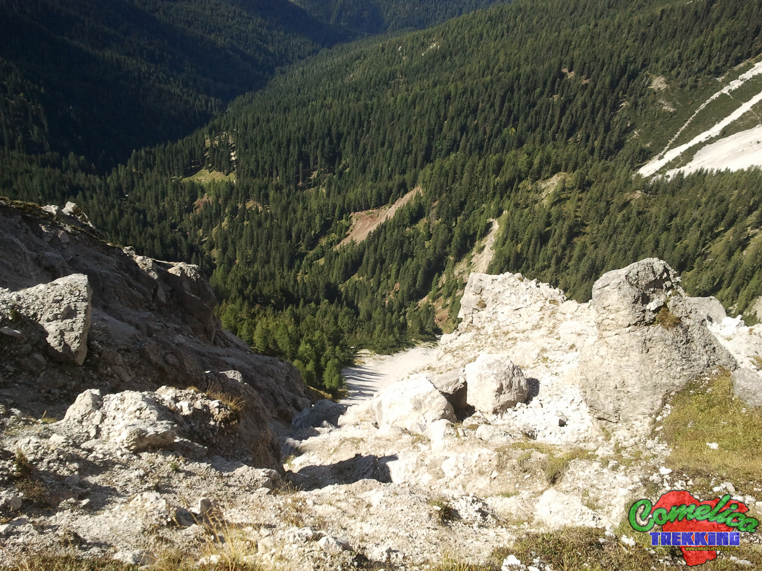
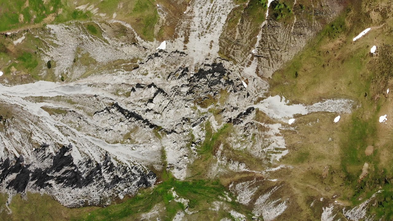
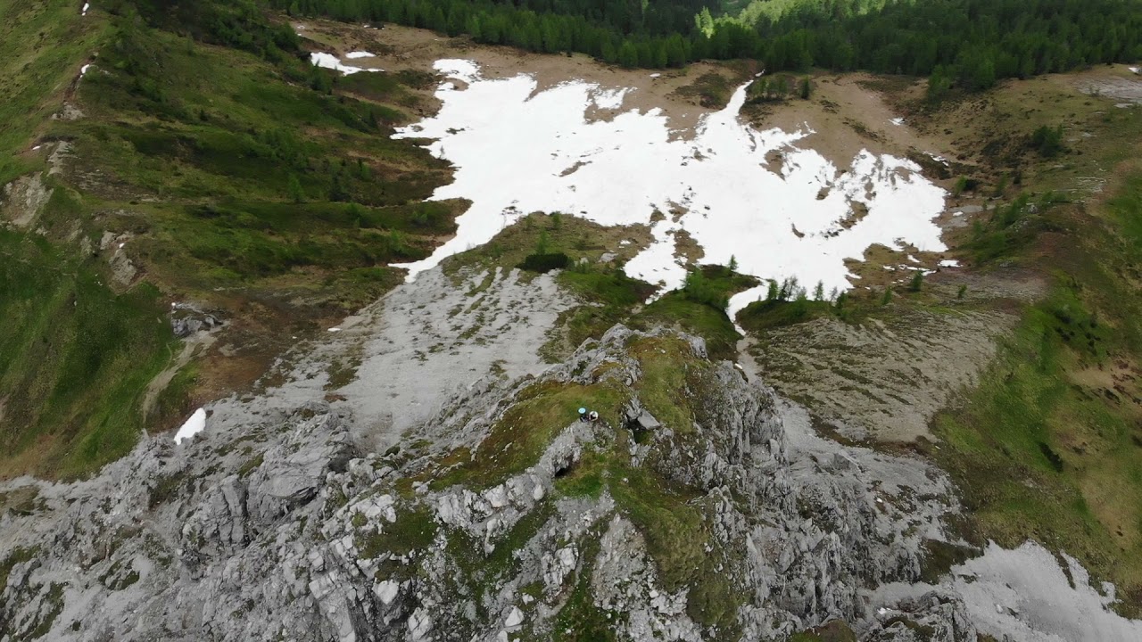
After a first flat stretch, the slope becomes more significant and even the pebbly terrain does not help us. As we climb through the gorge on its left side, that of Mount San Daniele, we observe the rocks of the two mountains getting closer and closer, closing the route to the north. About halfway up this stretch of climb, we can look at the la “Pisandui” waterfall of the Rio di Vissada, after which we enter Val Vissada. Once through the gate that prevents grazing animals from escaping, the valley is still very narrow between the two mountains, continuing to climb, it widens gradually, giving us wonderful colors in any season we visit it.
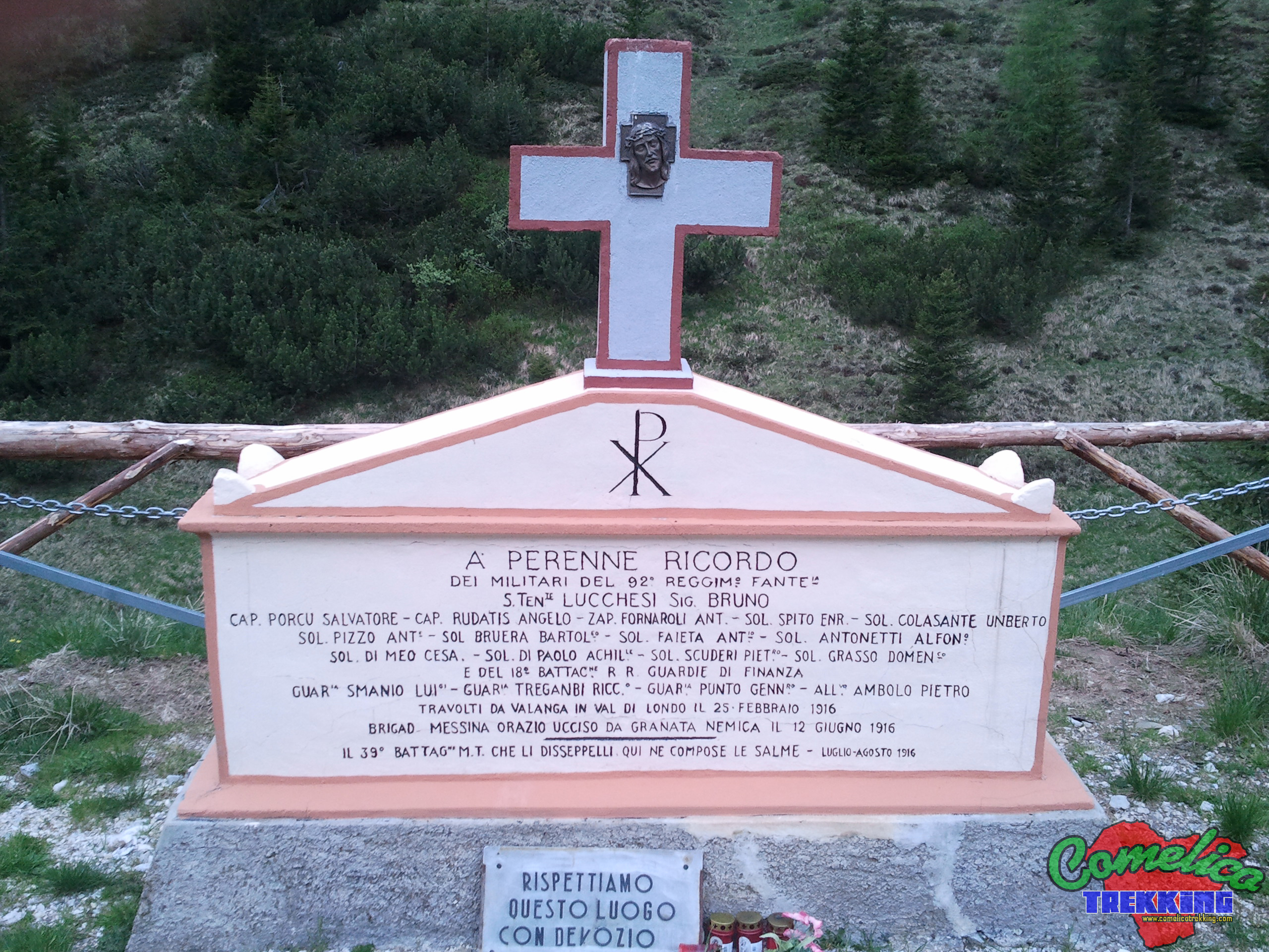
When we reach about halfway up the straight road that climbs along the right end of the valley, we can visit a commemorative military memorial stone. We have to leave the CAI-169 trail sign and cross the pasture to the left, until we reach the banks of the Rio di Vissada.
It recalls the history of the 92nd Infantry Regiment and the 18th Battalion of the Guardia di Finanza, overwhelmed by the avalanche in Val di Londo on February 25, 1916, and of the Brigadier killed by an enemy grenade on June 12, 1916. In this place the 39th Battalion composed his bodies during the summer of July-August 1916.
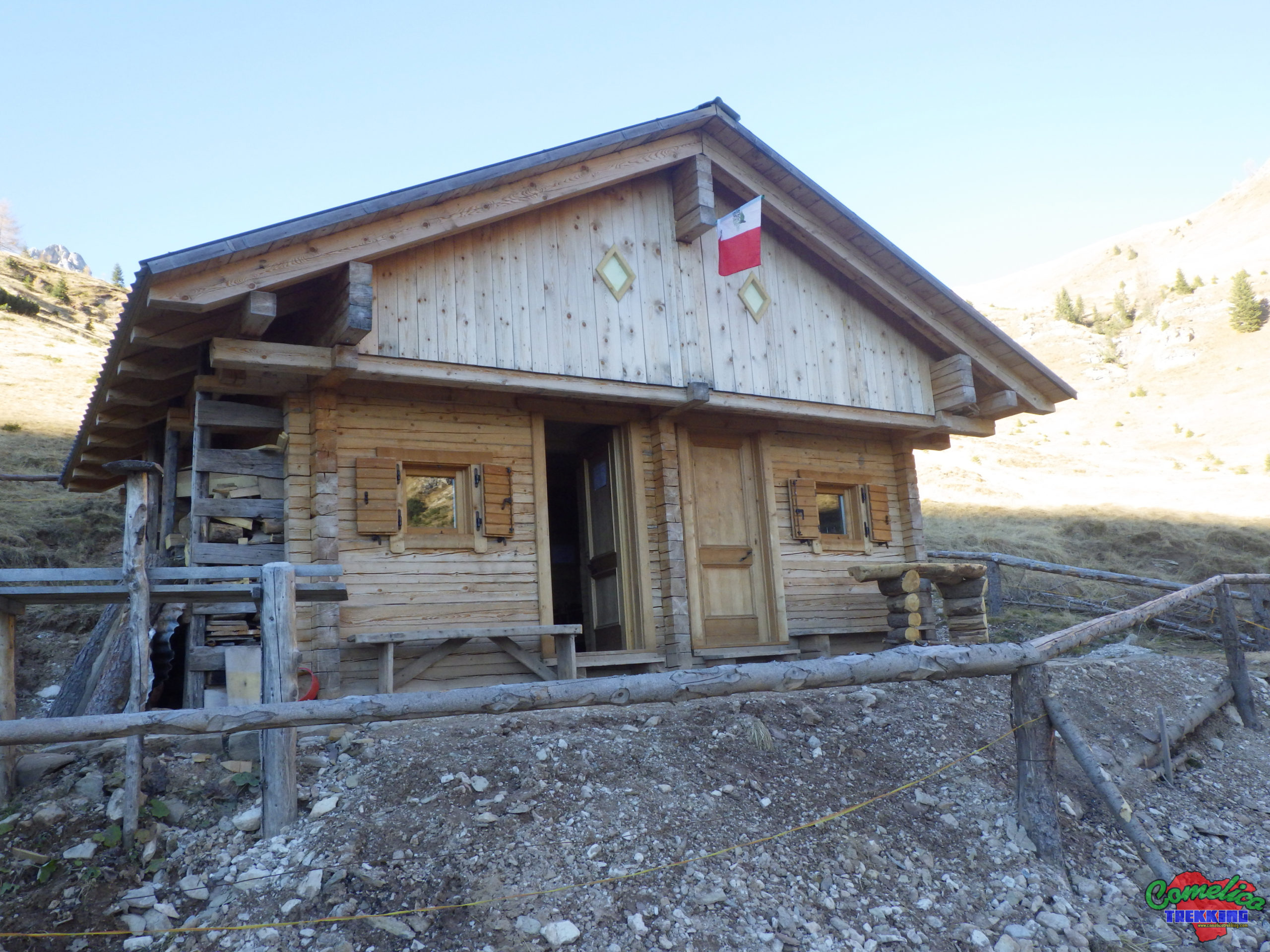
A few hundred meters to the north we find the Val Vissada Bivouac, recently restored. After having refreshed ourselves, we resume the climb always on the CAI-169 trail sign which now runs on the side of Monte Schiaron. From the bivouac in a short time we are almost at the top of the valley. We walk along an easy mule track on a slight slope, which takes us in about half an hour to cross the path that comes from the Col dei Pradetti CAI-165. Now we turn right onto the path with CAI-196 trail sign that brings us closer to the top of Mount Schiaron.
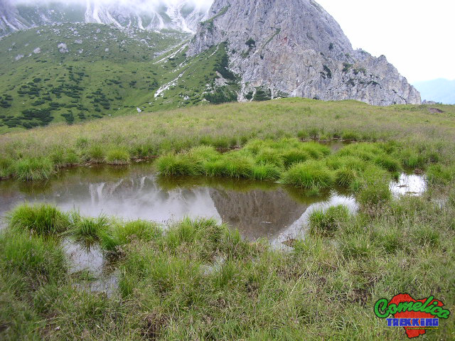
Shortly after the junction we can observe the ruins of the M.ga Vissada which once housed sheep. Just above the path, hidden on the plateau, we also find a small lake that serves as a water supply for the heifers present on the pasture in summer.
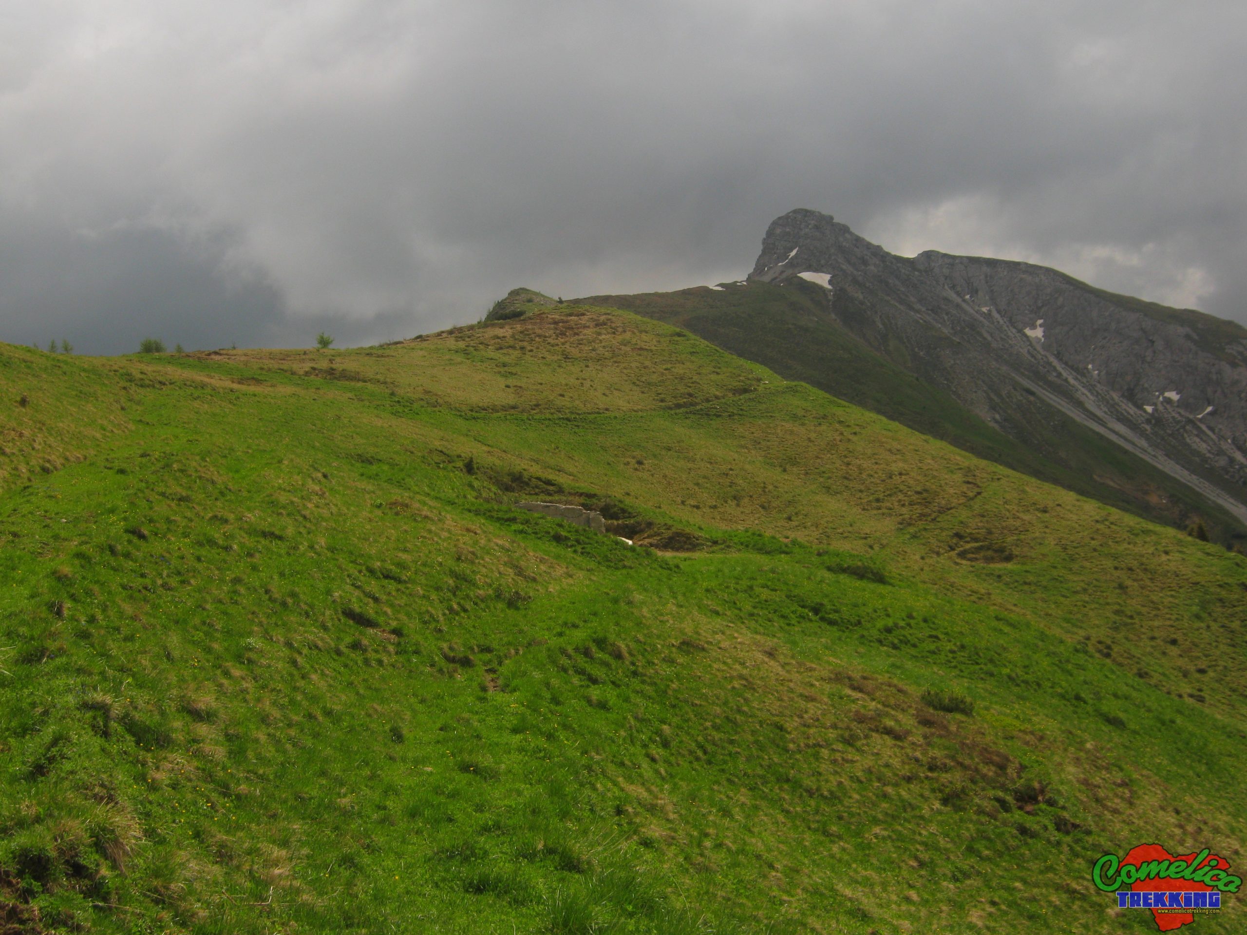
We are at the top of Val Vissada and the path runs almost on the landslide edge overlooking the underlying Val di Londo. Here the track is well marked and crosses the pastures on a slight slope towards the mountain. There are remains of defensive trenches on our left.
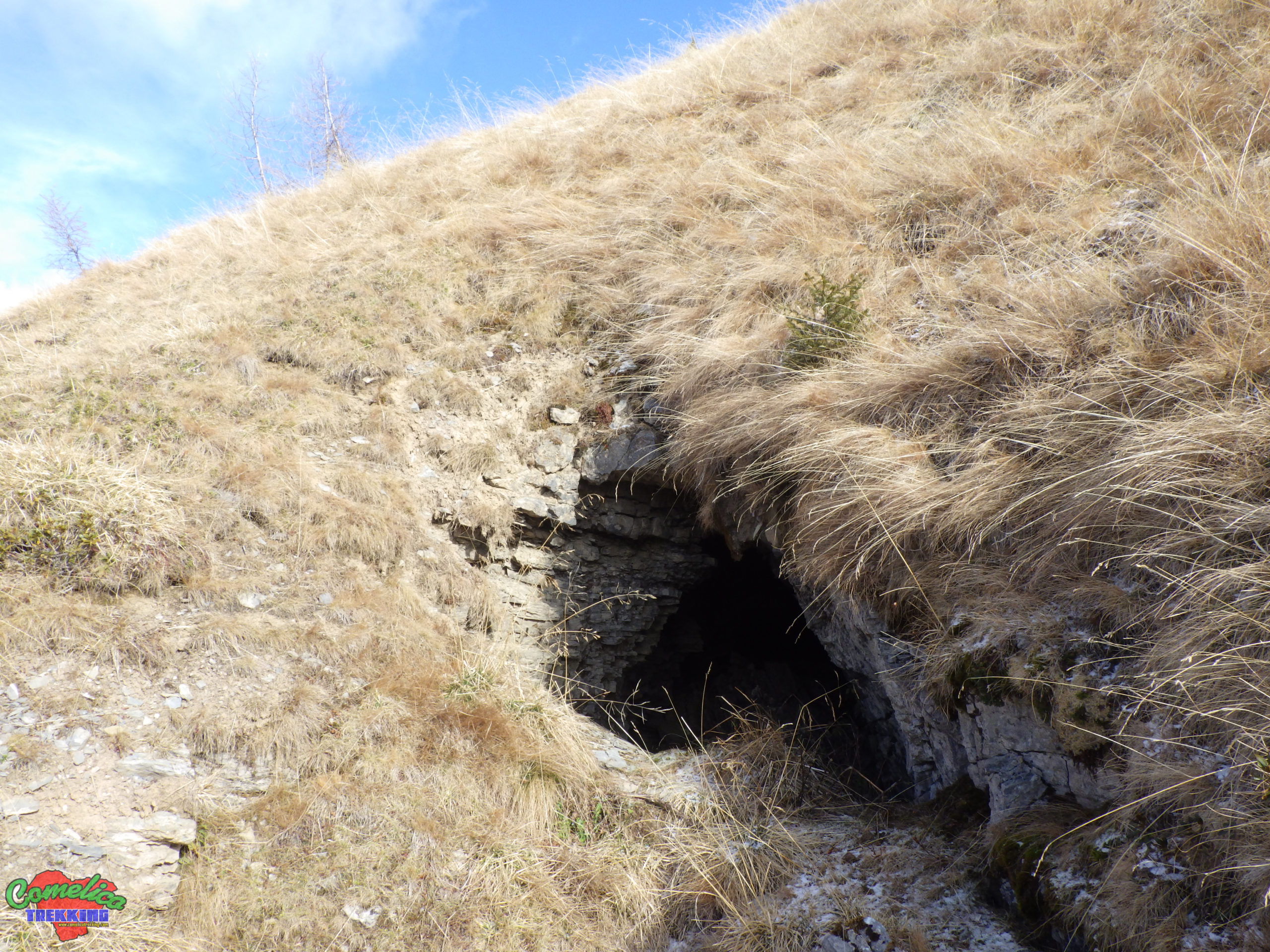
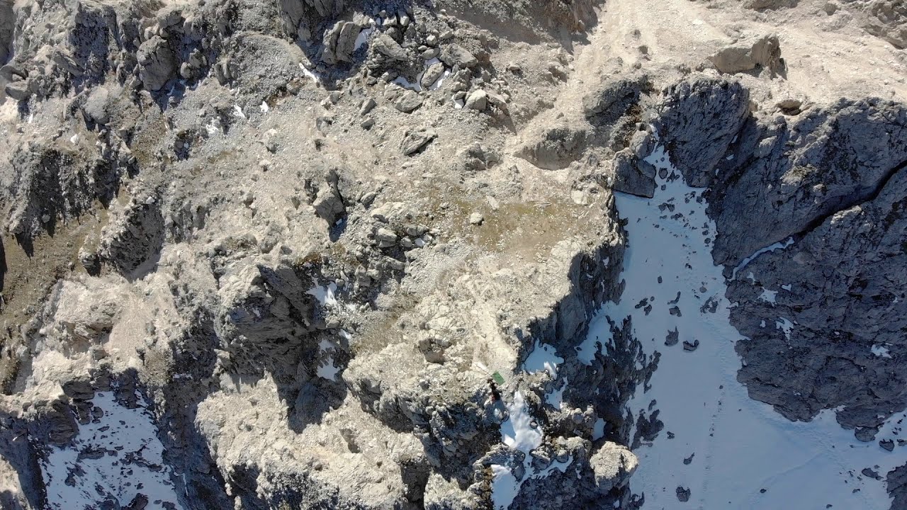
We begin the climb to the mountain always on a well-marked track and through meadows, now become much steeper. There are some appostamenti in caverna dating back to the Great War. They wind inside the rock for a few tens of meters, in branched tunnels. There are more entrances, but their visit is highly discouraged. Due to their state of degradation, approaching them is very dangerous because they are unstable and at high risk of collapse.
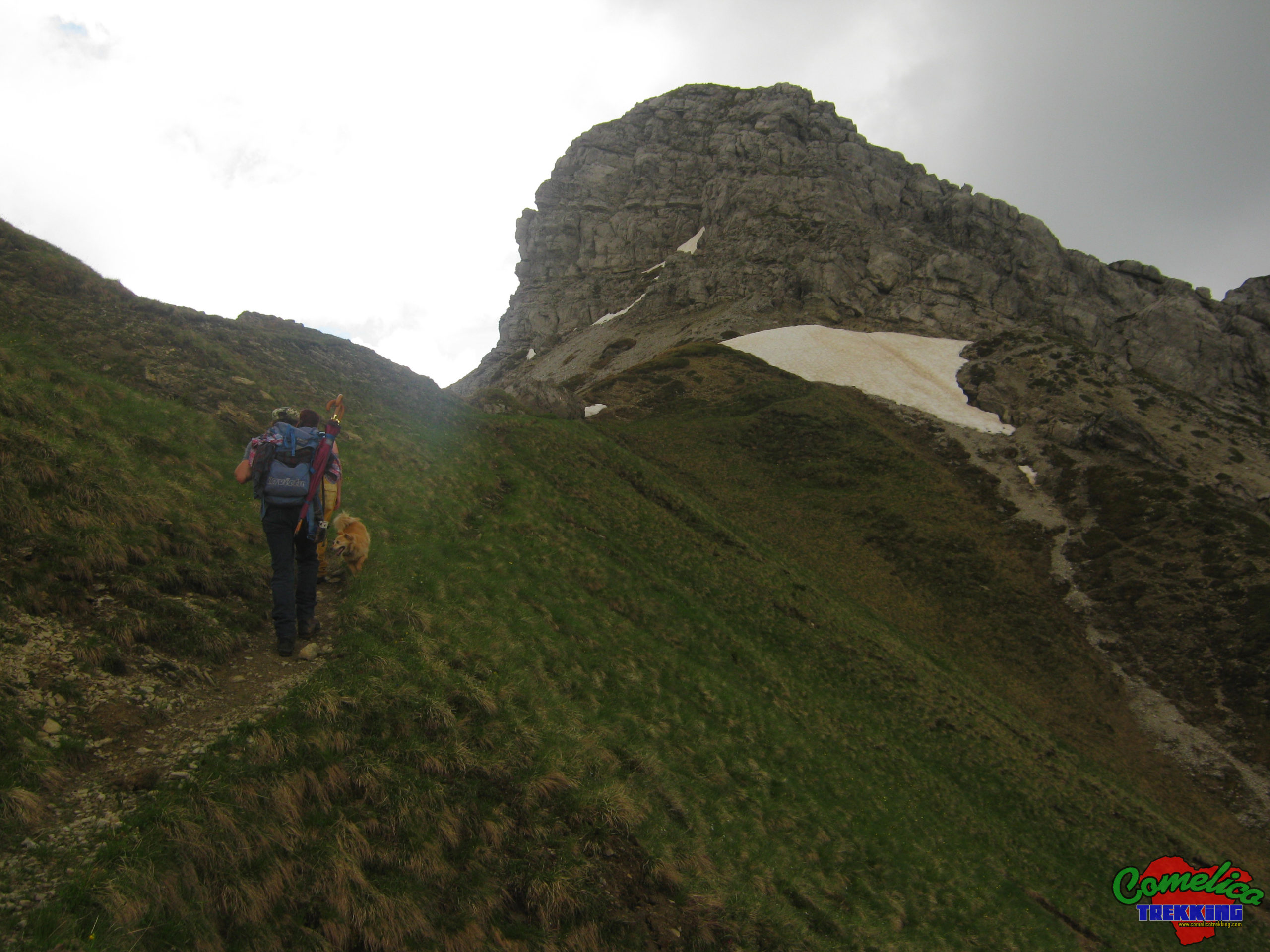
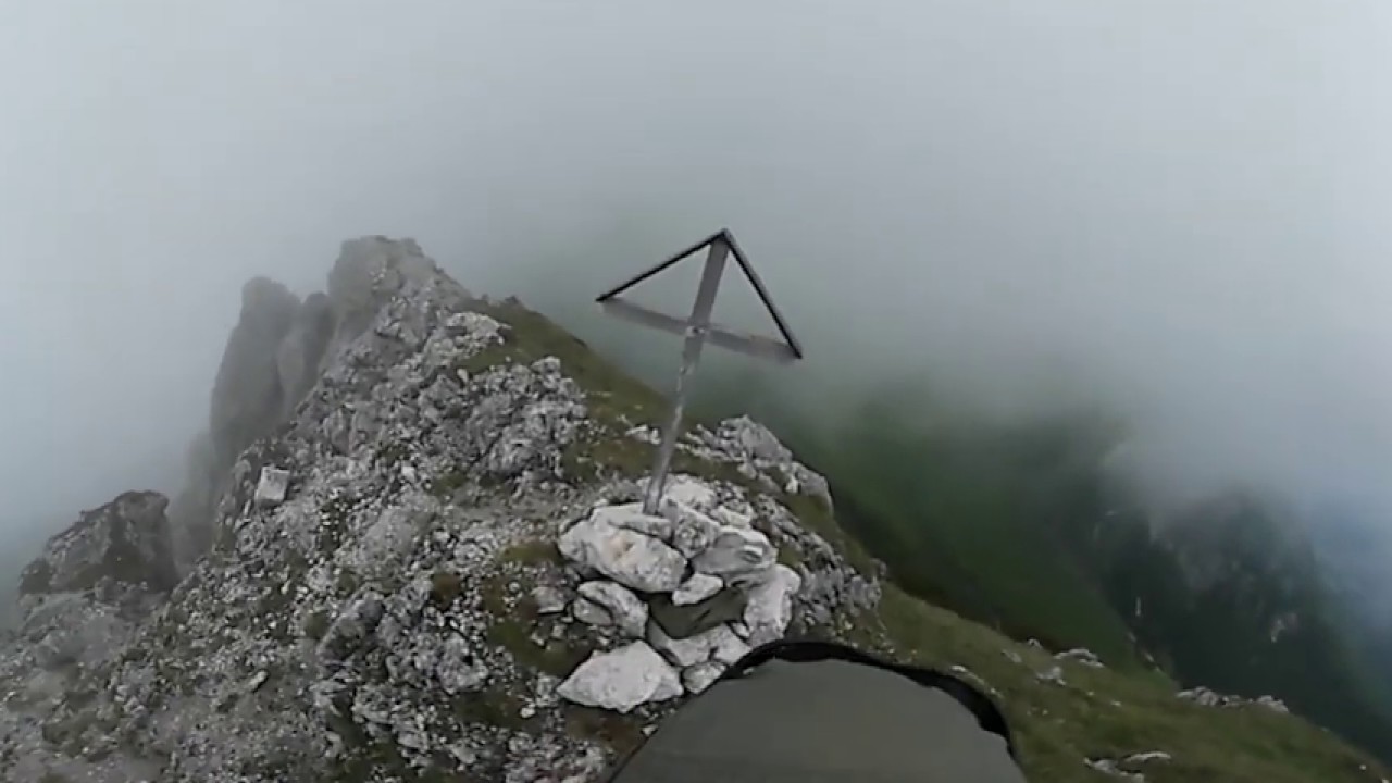
Still through meadows, in a short time we arrive at the F.la below the summit that allows us to peek at the Val di Londo. From here the path runs on the rock of the mountain; approach it for a hundred meters, then climb to the center of the summit along a wide landslide gully. At this point, at the top of the gully, we can decide on two routes that will take us to to the summit.
The path on the right: it is certainly the most suitable for cowards, climb over the large boulder on our right and following the stone signs, cross the peak horizontally, along the gravel, until you reach the opposite grassy F.la. From here you climb comfortably to the top from the north-east side of the mountain, zigzagging over the meadows.
The Left Way: You reach the top of the rocks and have an exposed passage, in which you have to cross a steep gully, on the north side, crouching slightly to pass under some slightly protruding rocks. Beyond this point, you always climb over rocks to the summit bypassing it counterclockwise, the last small stretch consists of the ascent of a very steep meadow.
This route, as well as being more adventurous, allows you to observe the cave sattlement dug directly into the top of the mountain. It has an entrance to the west, before the ascent meadow, and artillery loopholes to the north. But it is dangerous and is no longer used. The settlement is also in a poor state of preservation and unusable in safety.
From the top we can see other trenches descending along the ridge of the mountain in the direction of Val Visdende.
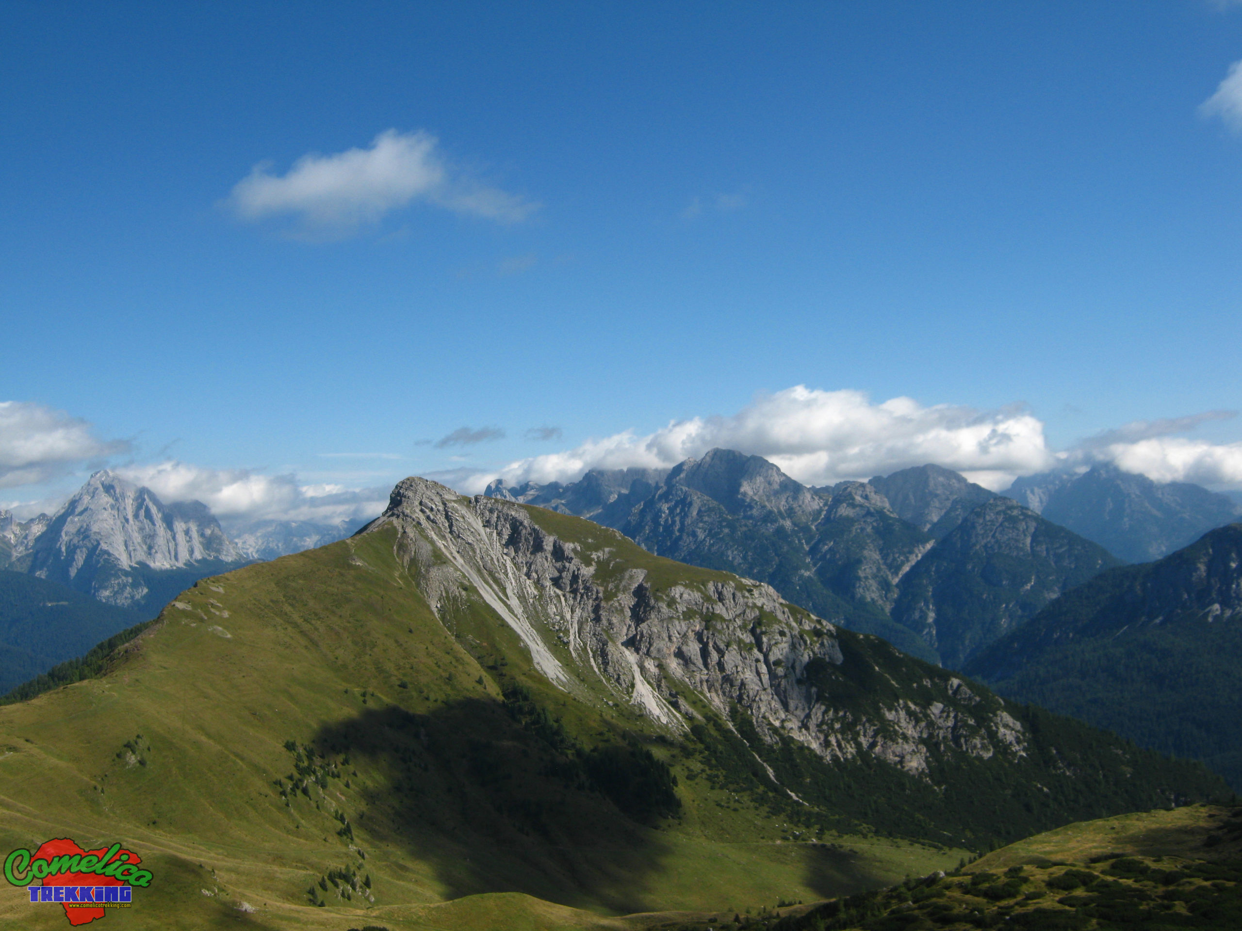
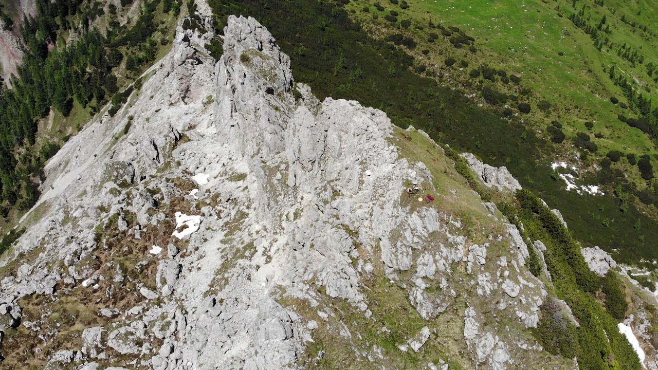
We walk downhill towards the Crode dei Longerin and in half an hour we have comfortably descended from the Schiaron. We are at the F.la Longerin, ready to undertake the climb to the highest peak of the itinerary, which must be undertaken by crossing the complex and passing between the Torrioni and the Crode dei Longerin.
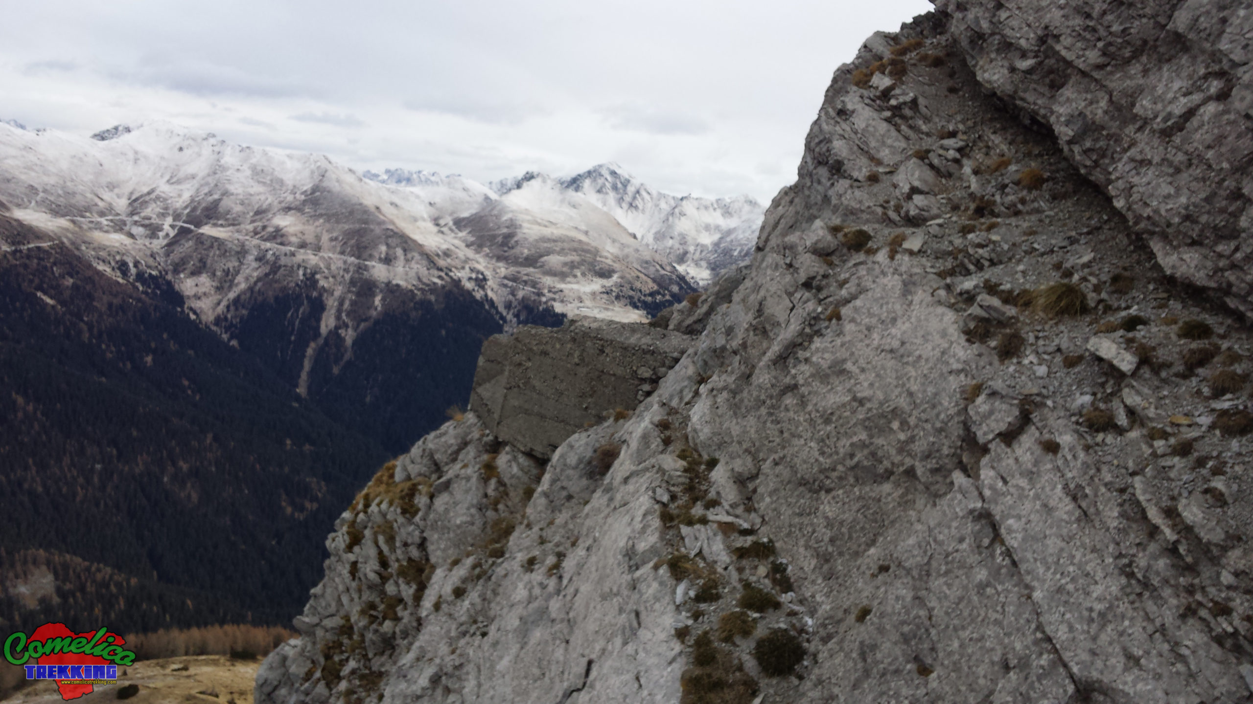
From the Longerin F.la we take the path marked CAI-195. It soon climbs in altitude in a westerly direction and then turns north to under the Torrioni, where the CAI-165 path passes for the P.so Palombino.
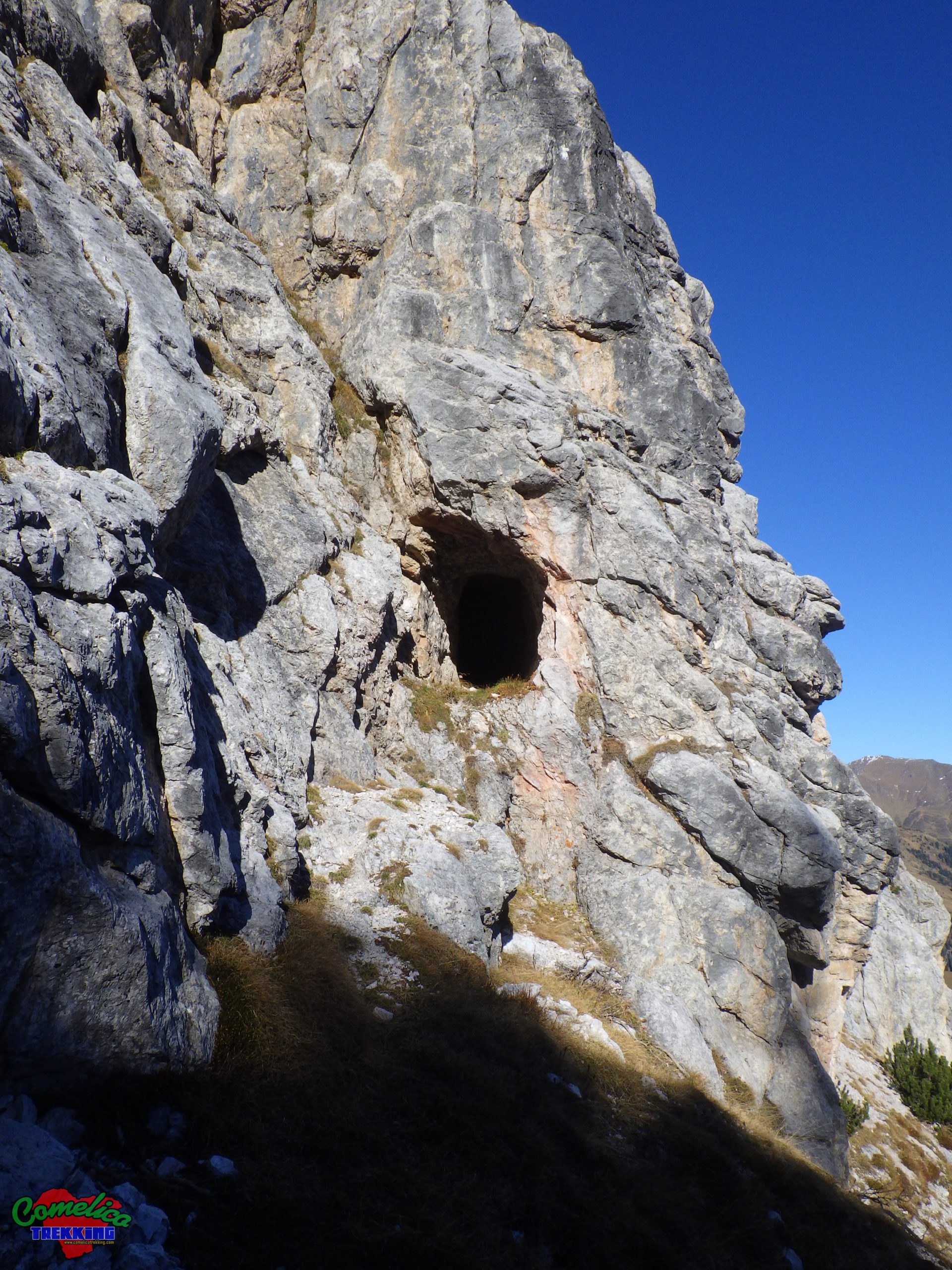
Around the Longerin F.la, facing the Towers, we can descend slightly along a path half-hidden by pine trees. Continuing on a slight slope on gravel, it leads to a tunnel carved into the rock dating back to the First World War. The eventual shelter goes into the Tower for about fifteen meters and ends on the other side, where we find an artillery loophole that offers an unprecedented view of the Val di Londo and of Valle dei Longerin.
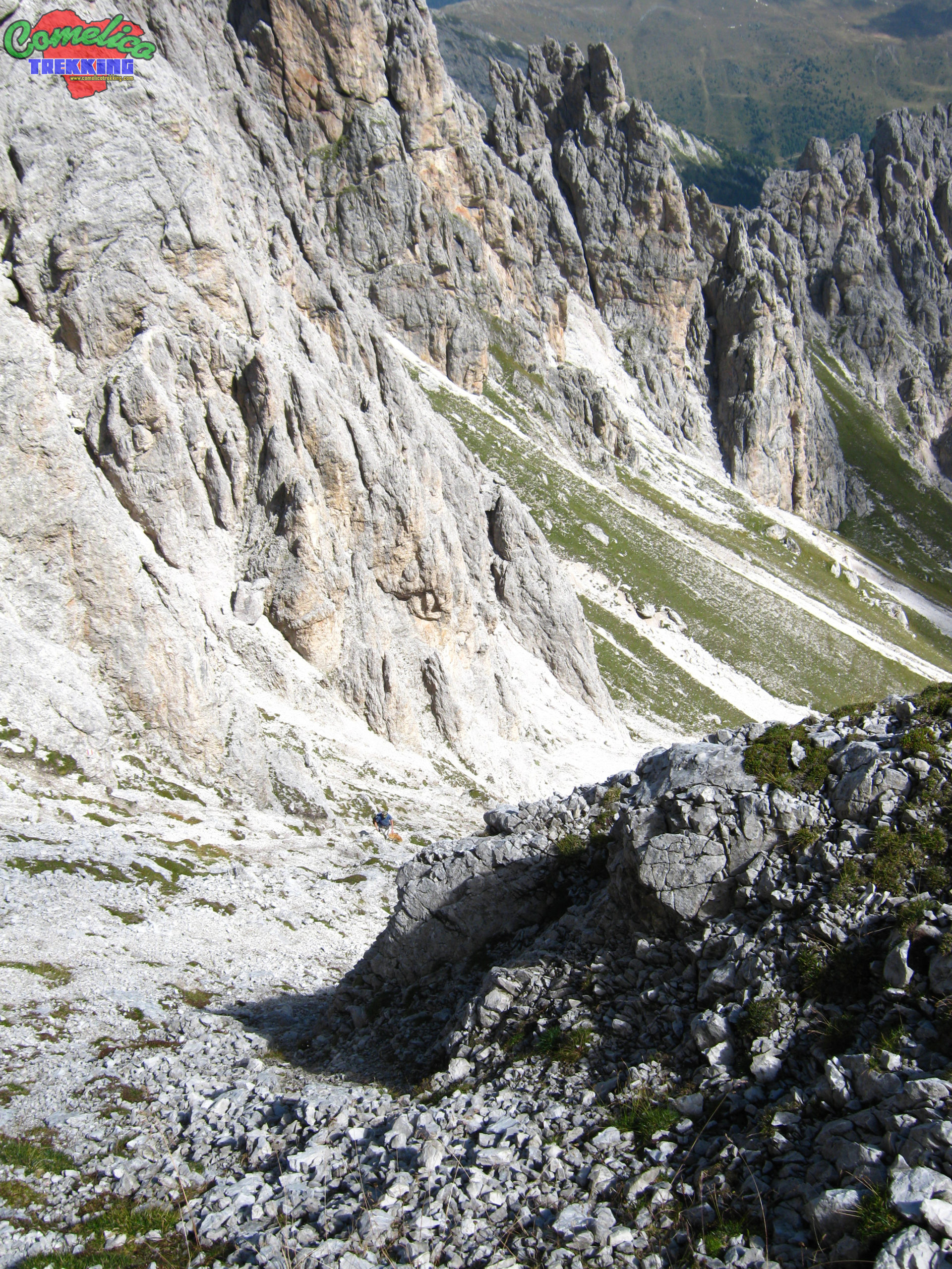
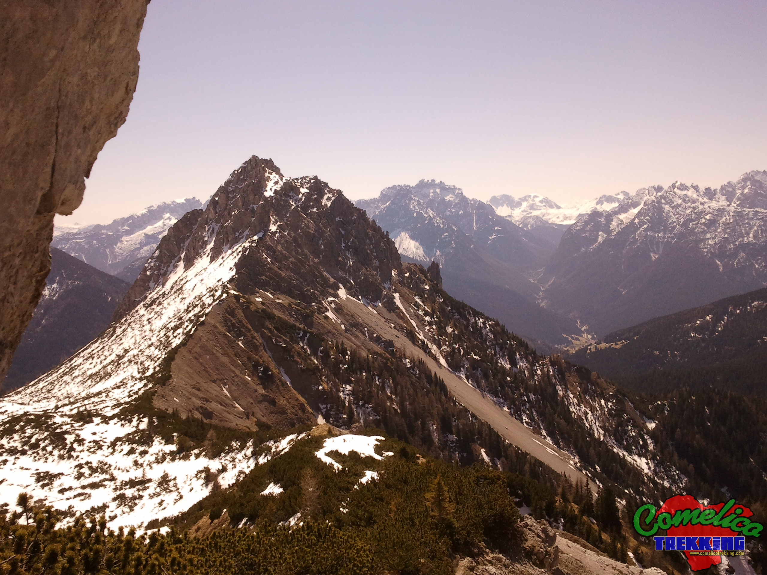
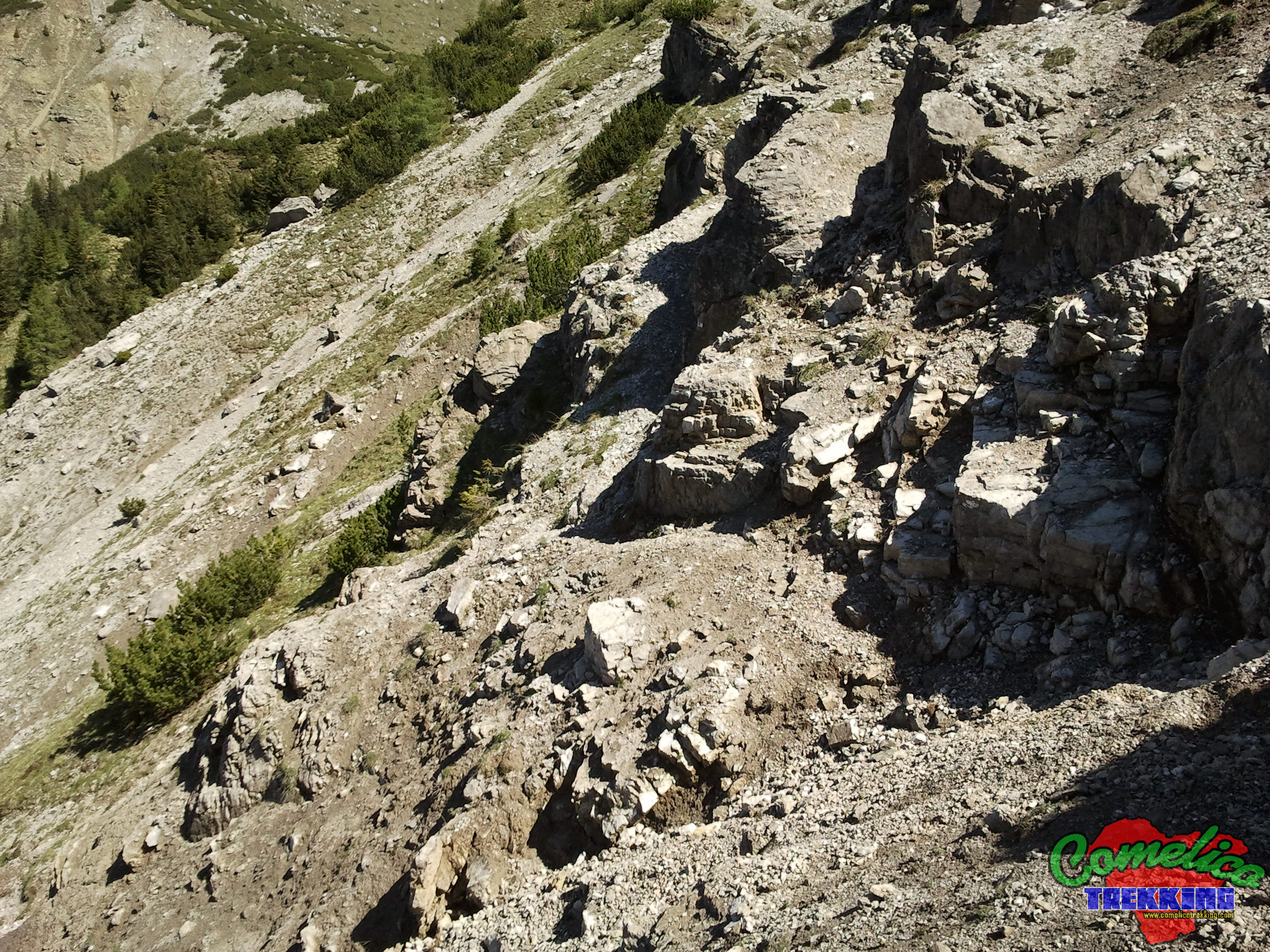
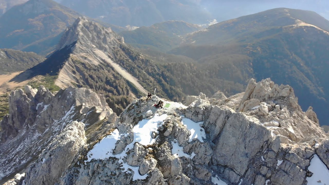
At the junction with the CAI-165 trail marker, our path becomes slightly gentler and crawls between one rock and another of the natural arena of the mountain, skirting the right side of the basin. When we reach about halfway it rises sharply, we have to follow the flags from one boulder to another and walk through steep and gravelly meadows. Climb westwards until you meet a fork between I Torrioni and Le Crode dei Longerin; a short stop to catch your breath and admire the view over the mountain, towards Monte Spina and Col Quaterna’.
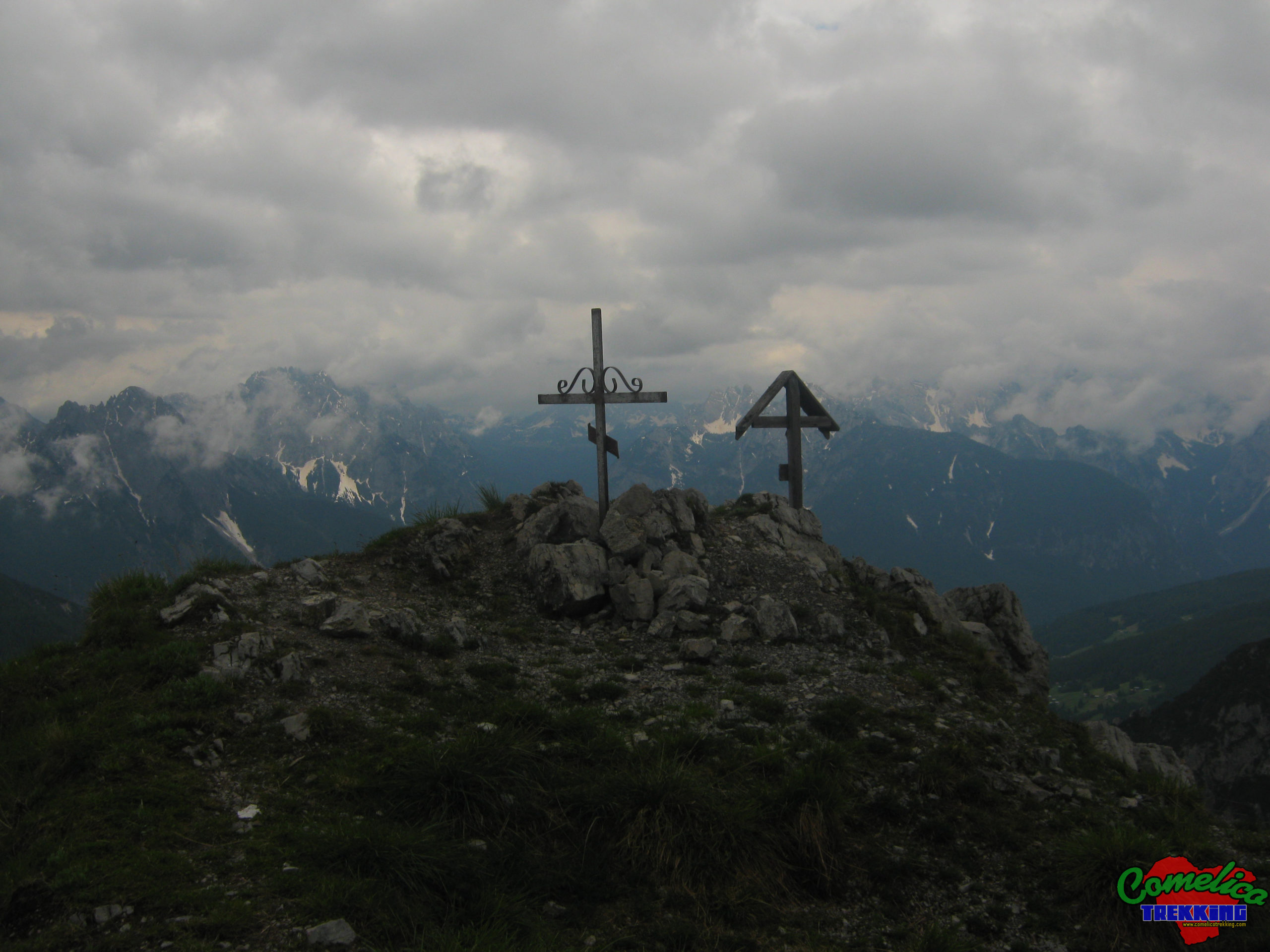
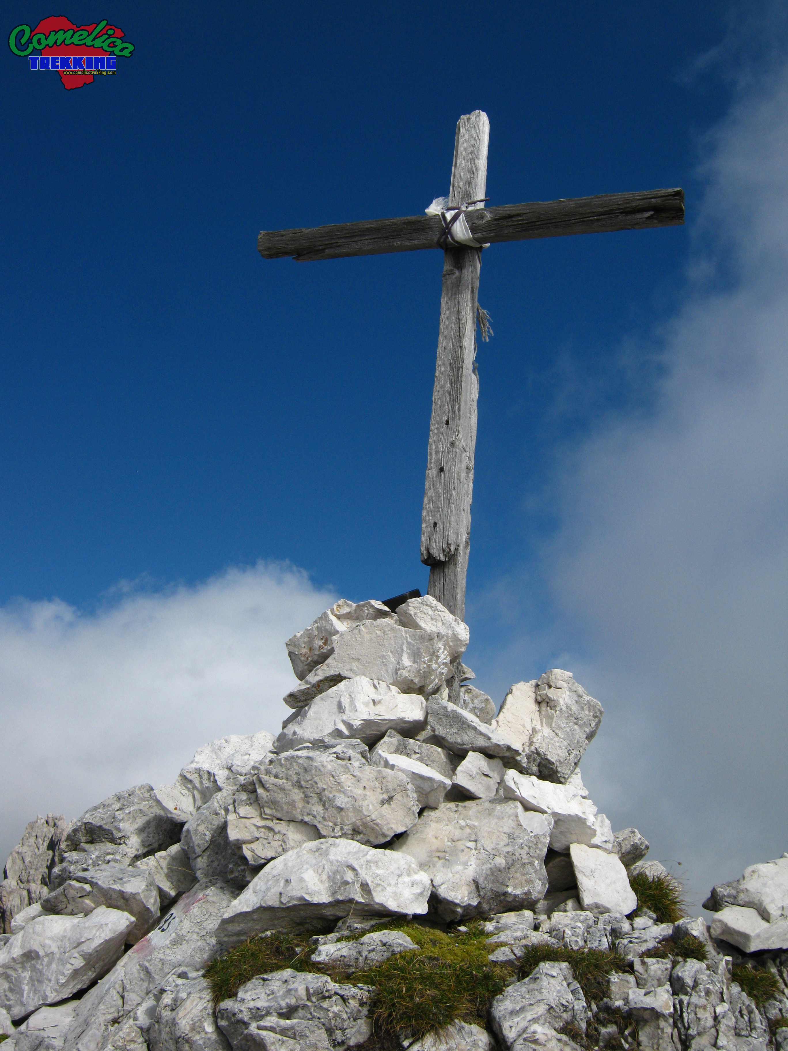
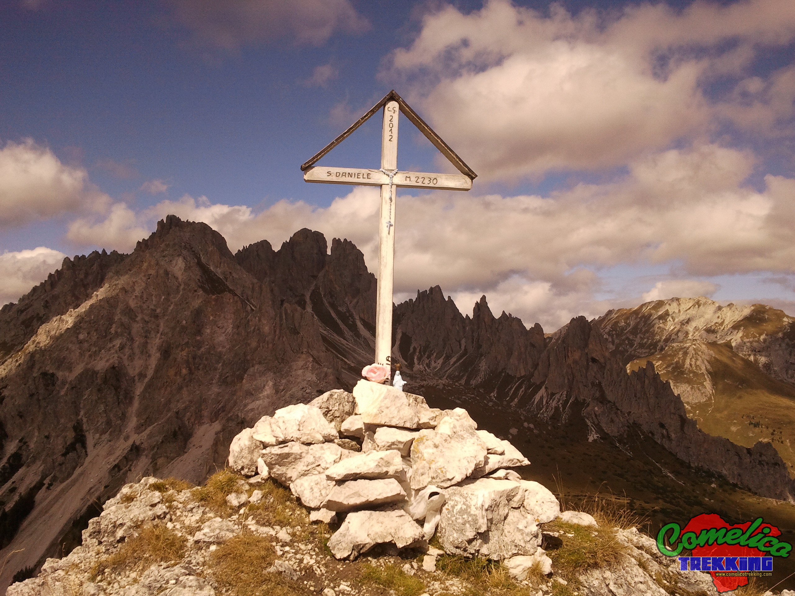
We set off again turning south, and we undertake the last very steep gravel stretch, skirting the rock walls. Now, on a marked track we climb through the opening that at the end leads us to ride the mountain. We arrived on a small stony plateau with a view of the south side, towards Monte San Daniele, from here the narrow Cima Sud is a few steps away. The view on clear autumn days is indescribable.
The itinerary continues descending from the top on the south side of the mountain on a custom path and therefore without official CAI trail signs; there are several stone cairns, and the trace is often visible.
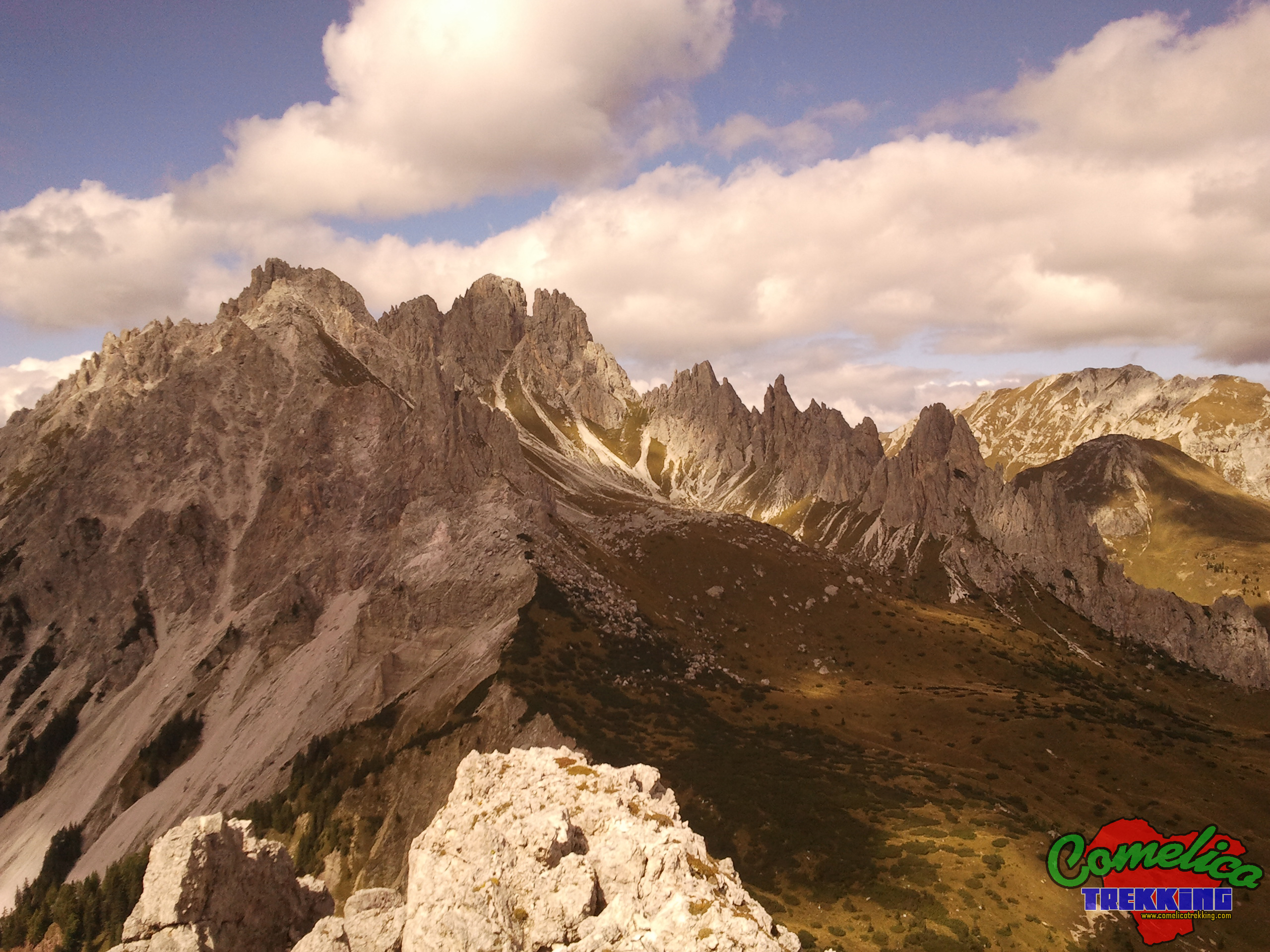
Initially you lose altitude crossing the rocks that form the top, always keeping towards the edge that looks much lower at the Ferrera Forest. Here the track is well marked and distinguishable. Once you reach the towers, you have to descend through a grassy gully and pass under a spire. Below we can see the ‘Drota delle Pere’ that are harvested in the natural process of erosion. At this point, we can choose: go straight down steep meadows, or decrease in altitude gently, skirting the crags on our right and zigzagging.
In any case, cutting the upper part of the arena towards the south-east, at about 2250 m a.s.l., we cross the path that takes us beyond the last spire below. Finding the path well marked, we follow it and leave behind the “Drota delle Pere” passing the last Tower of the Crode dei Longerin.
Now the descent is much easier and less steep, as you descend the path reaches the north-east edge of Val Vissada for rocks, the one that gives up Giao Storto.
Then you have to cross the mountain pine forest slightly downhill, sometimes passing between them and sometimes descending carefully on the landslide side of the valley. In the final stretch, we leave the edge of the valley for a short crossing in the vegetation, beyond which we will cross the path marked CAI-165. It climbs through all the Piani di Vissada coming from the F.la Longerin. We take it and climbing, we soon arrive at the F.la San Daniele.
The penultimate stretch sees the optional climb to the solitary summit of Monte San Daniele, the path has no official signs and is marked by stone cairns.
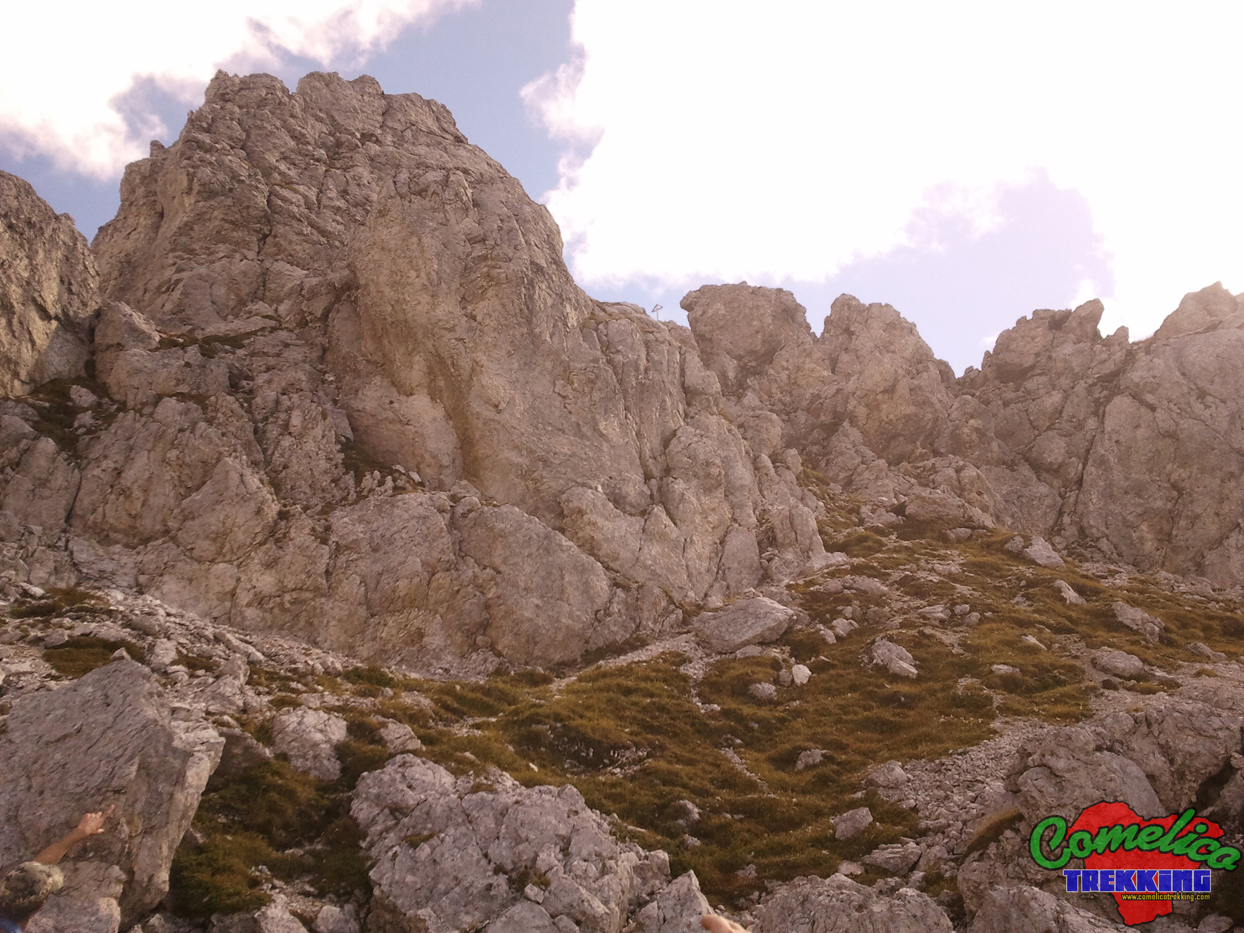
We start at the fork of the same name, before crossing it to descend, we turn 90° and oriented towards the south, we slightly climb the crest of the mountain on the Val Vissa side. After passing the first small scree that climbs, we continue among the pines for a few more tens of meters. Now the track climbs steeply to the right until it reaches the ridge and then continues on the other side for gravel.
You pass by climbing the screes that overlook the Valley of Giao Storto helped by some recently installed metal ropes. Still oriented towards the south, we proceed on a stony and no longer demanding path, until we reach a small plateau below the summit. Now turning 90° eastwards we face the last climb that leads to the summit paying attention to the slope that becomes more challenging.
We continue the last stretch of the itinerary returning to the F.la San Daniele along the same road already taken uphill. Once we reach our destination, we take the path with CAI-165 trail sign again, this time downhill, in the direction of the S.la dei Pradetti.
The first part of the path winds mainly horizontally, and descends slightly to the south, in this phase we cross the steep screes of San Daniele. We pay particular attention when crossing the last stretch where you have to climb slightly to resume the path on the other side. The last scree is descended for about twenty meters and from here the path proceeds through mountain pine woods and steep meadows, until it reaches the Col dei Pradetti encountering a few hairpin bends.
In the second part we find ourselves in the fir forest, the road gradually becomes less steep and wider. We pass a private hut near the Colle dei Pradetti and in about ten minutes we arrive at the saddle of the same name where our stretch of travel with CAI-165 trail ends, which continues to M.Zovo. For the return, we turn left, continuing on a dirt mule track with CAI-154 trail sign that in an hour runs along the entire south side of San Daniele and takes us back to the starting point, the F.la Zovo.
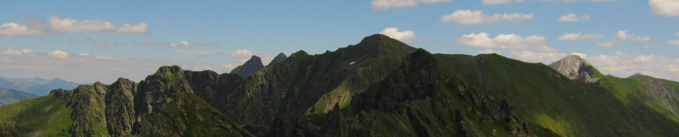
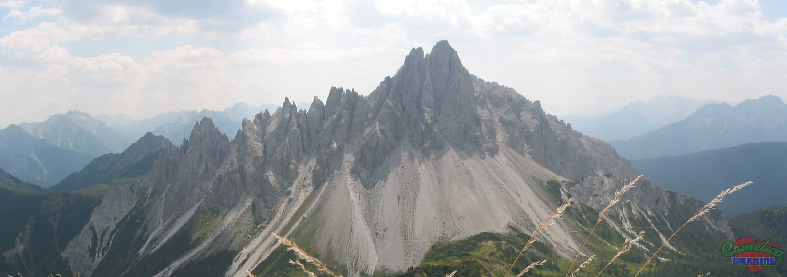
Monte Schiaron from the Longerini
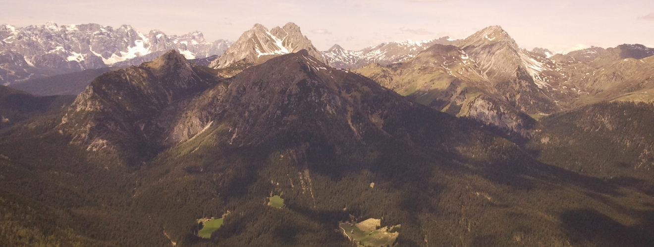
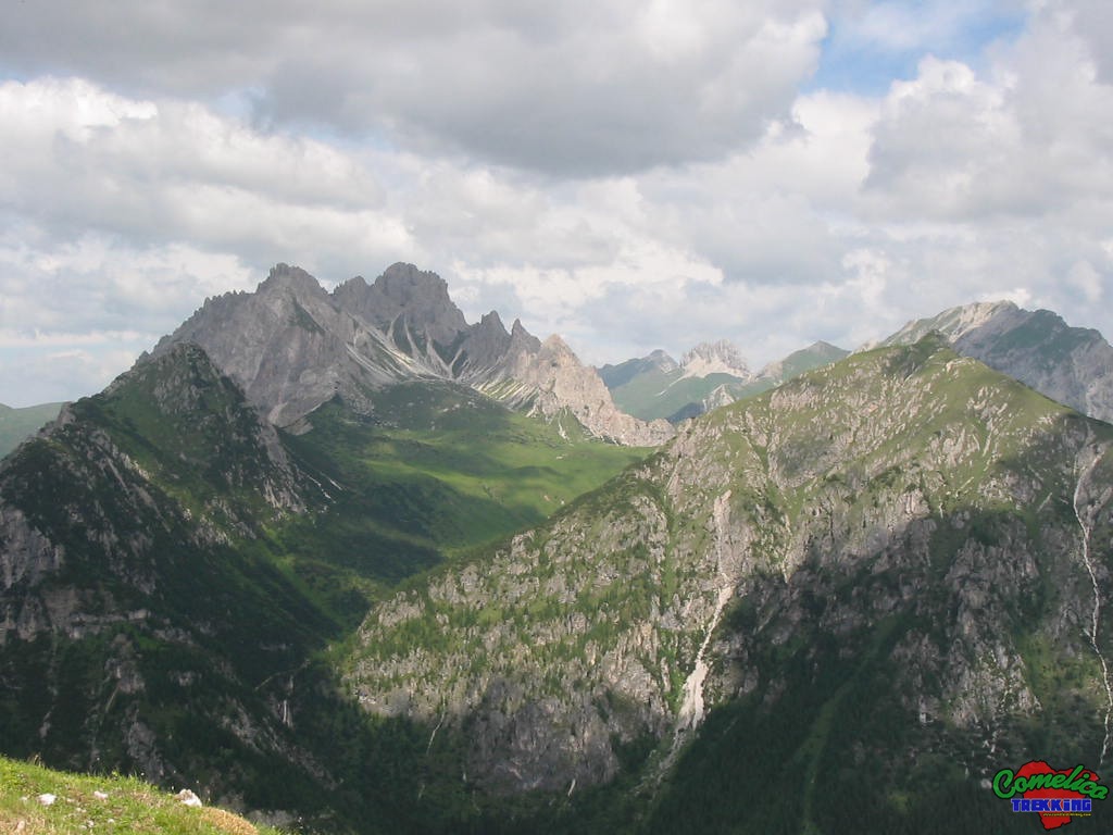
This itinerary is very flexible, it can be integrated or modified according to the needs of the hiker and / or experience. Val Vissada can also be reached from Val di Londo following the CAI-167-169 trail sign and from Val di Melin via CAI-165 trail sign. The whole area is surrounded by a myriad of municipal and forest roads that allow the approach from other sides and also a quick return in case of bad weather or need. It offers a unique landscape, inside the valley and also outside, when we are at high altitude, because the three mountains that enclose the Val Vissada rise in the center of the Comelico territory, so you have breathtaking views of the Val Visdende, the Italian-Austrian border, the 3 Terze, the block of Monte Spina – Col Quaterna‘ and also the Brentoni Group.


- 1
- 2
- 3
- 4
- 5
- 6
- 7
- 8
- 9
- 10
- 11
- 12
- 13
- 14