Monte Brentoni
Geographical Features
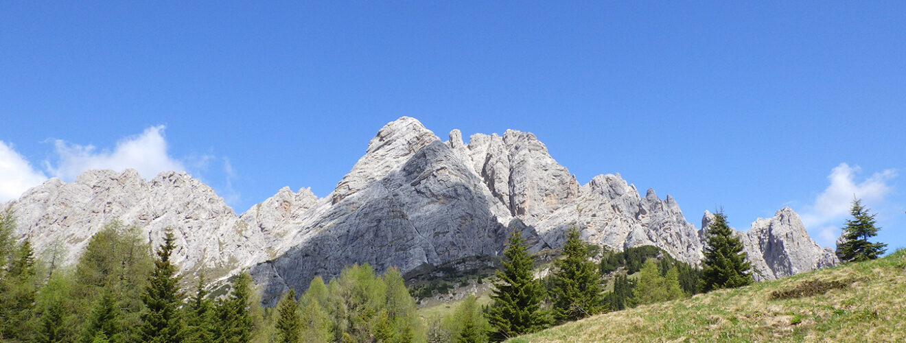
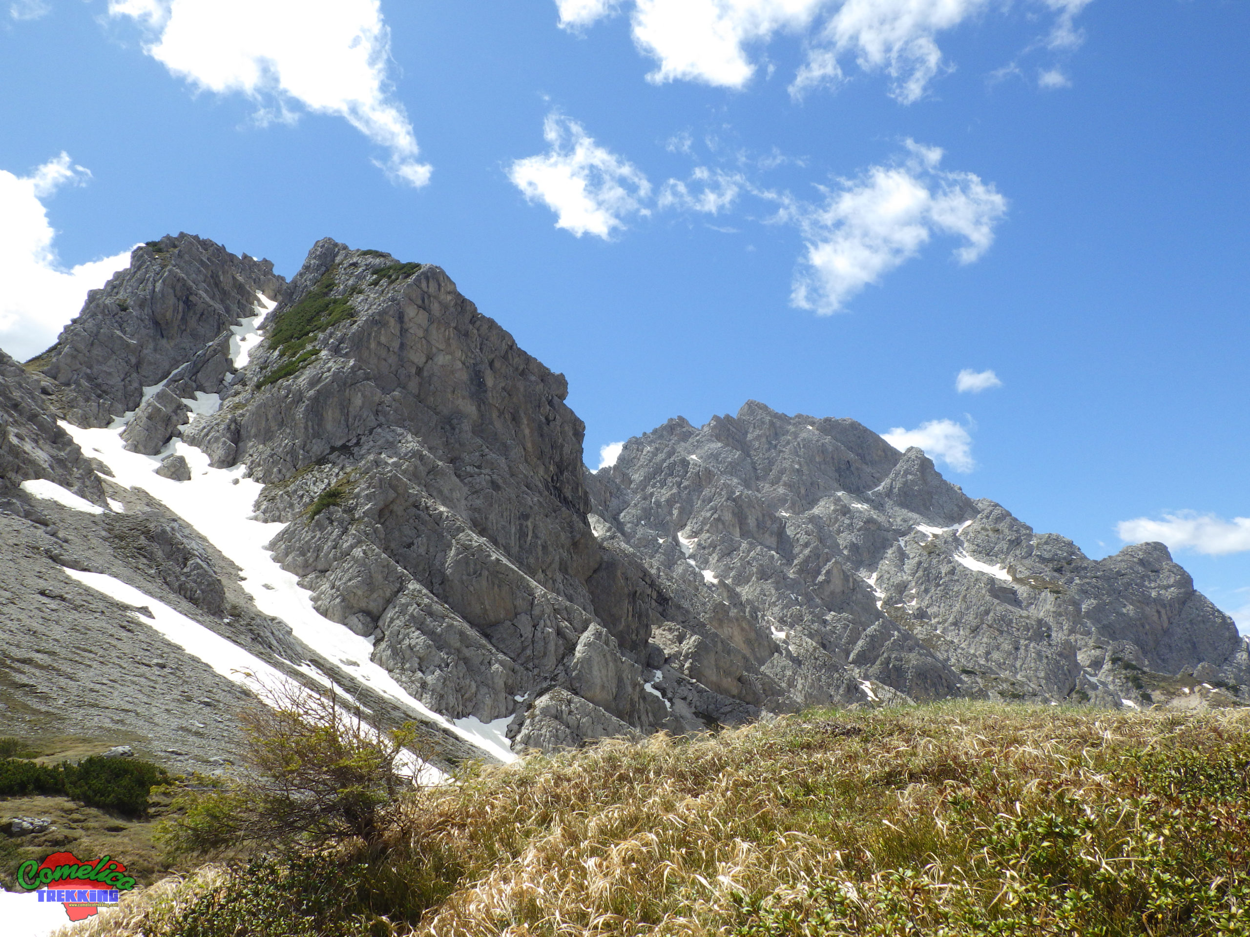
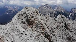
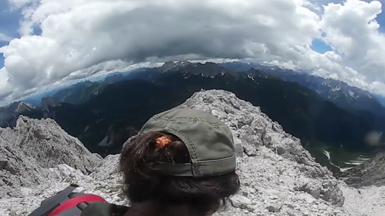
.the Peaks Monte Brentoni, or Brentone as it is called by some, looks like a splendid dihedral of compact rock which, if seen from the South, or from Cadore, has a conical shape and is very rounded like a tooth; This is the side from which the summit is accessible. Everything changes if you observe it from the Comelian side, from the North in fact it presents itself in all its splendor resembling a large pyramid with smooth walls, similar to the ‘Brent’ – or the planks on which clothes were once washed at the fountains – which determine its name.
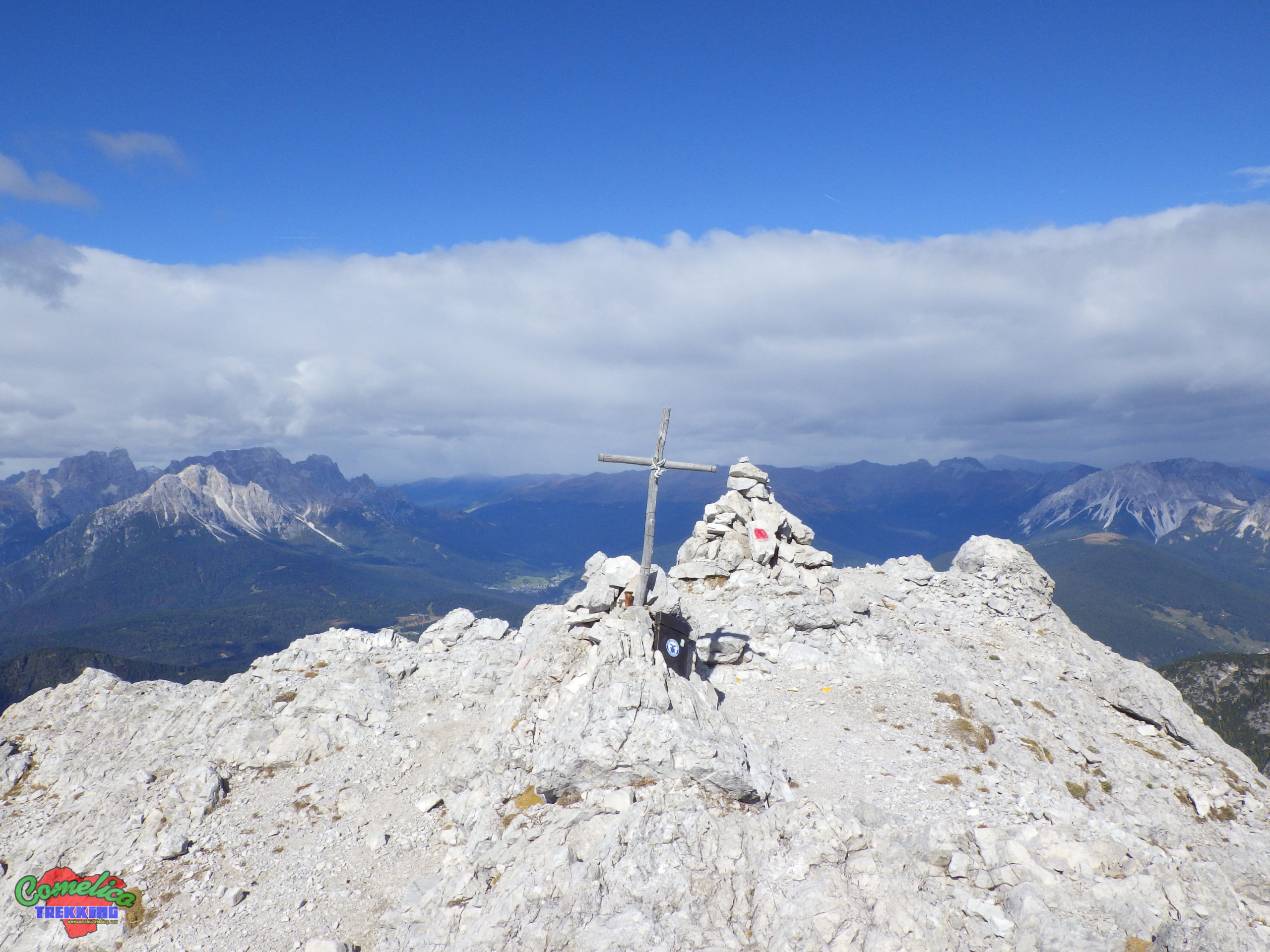
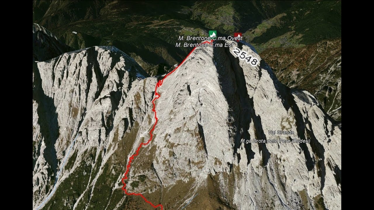
The Brentone, together with M. Cornon, the C.de di Mezzodi’, M. Pupera, M. Crissin and M. Tudaio, is part of the Brentoni Group. Monte Brentone is the peak of the Group, its two peaks reach respectively the 2547 m a.s.l. of the West peak, which can be reached via a vertical via ferrata, and the 2548 m a.s.l. of the East peak, which can be reached later by carrying a rope with you for safe travel.
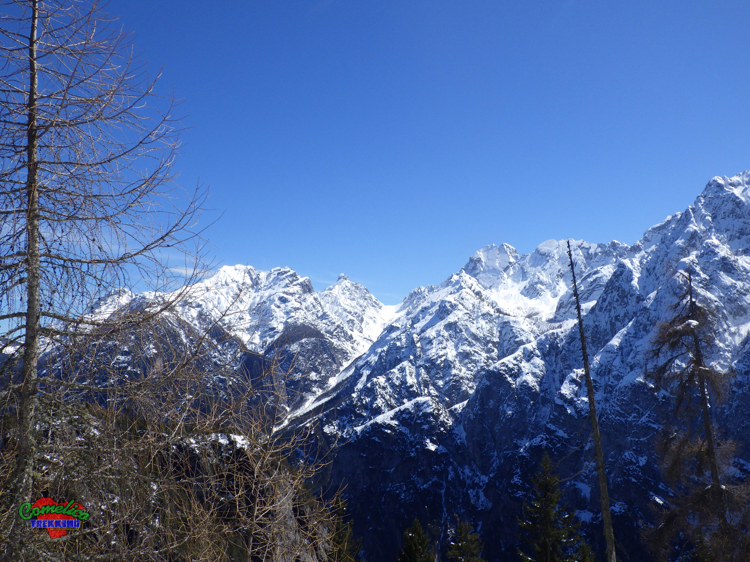
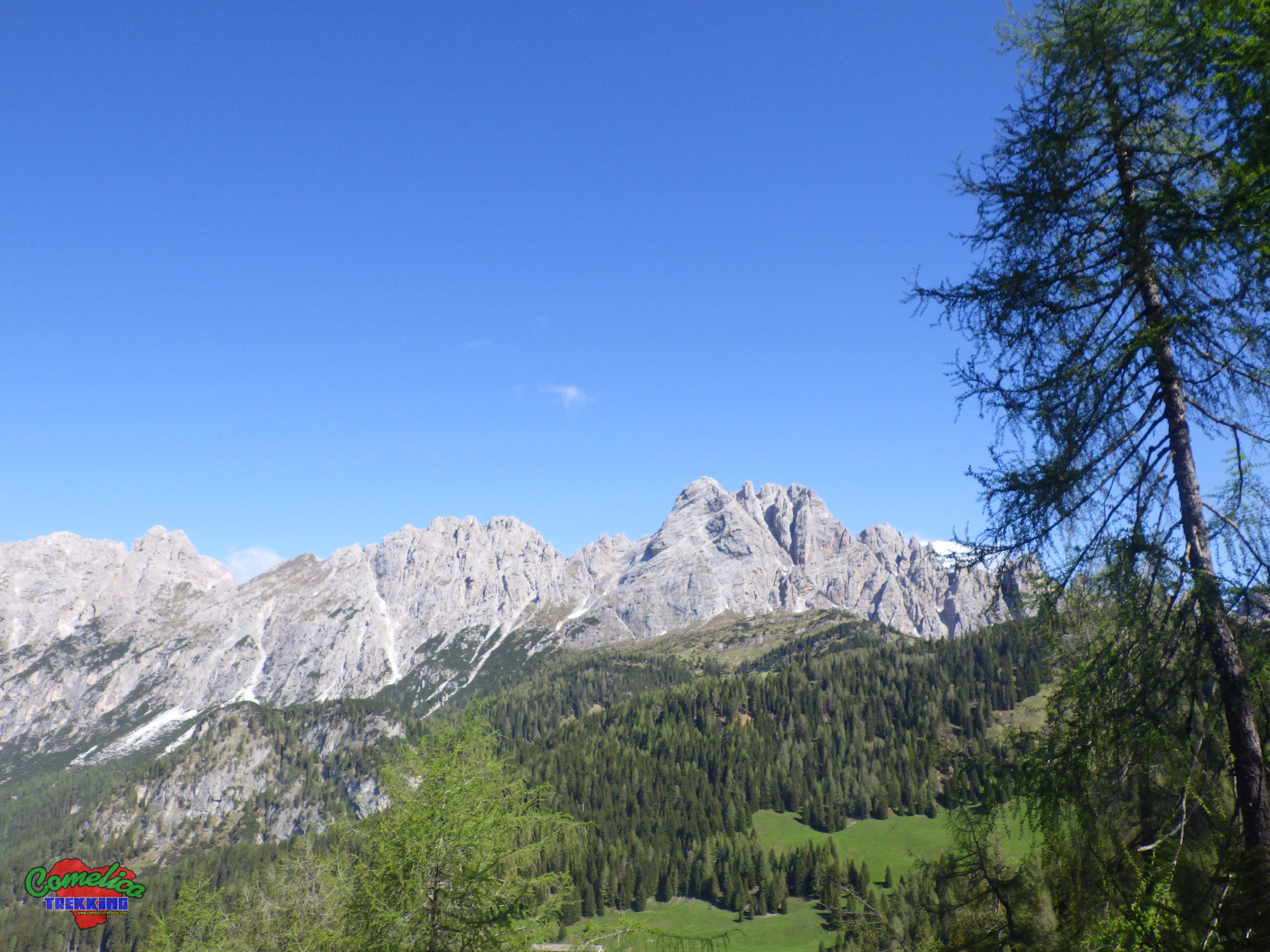
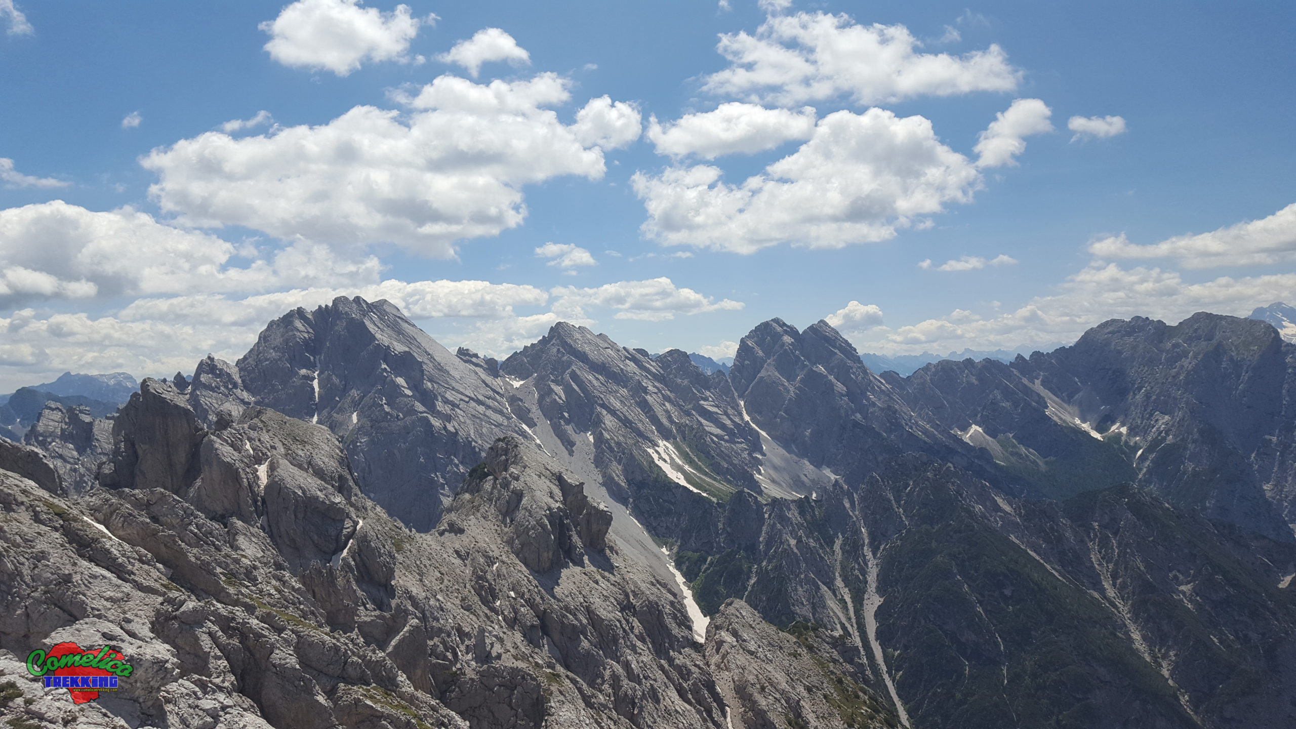
.the Valleys On the North side, Monte Brentoni overlooks the long Val Grande, while the South side overlooks the pastures and woods of the Casera Razzo plateau. The east side can be seen sloping down towards the wide F.la Valgrande with bell towers called Torrioni di Val d’Inferno that tower over the valley of the same name, while to the west, in addition to the narrow Forcella Homonymous, it progressively slopes into the Cresta dei Castellati until it elbows with the nearby Monte Pupera massif.
.the rivers The area surrounding the mountain is not rich in water sources, probably due to the presence of thick gravels all around that let the precious resource sink in, hiding it from view. During the spring rebirth it is possible to meet small small streams that descend directly from the crags. You can see the most important waterways, such as the Piova stream and the Rio Grande, only in the distance in the valley, a factor to be taken into account in multi-day adventures.
Political boundaries
The peaks of the Brentone, together with the Forks and ridges, determine the political boundary of the municipalities of Santo Stefano di Cadore and Vigo di Cadore. The first on the North side and the second on the South side.
The Approach
.from Valgrande Choosing to climb the mountain from the north we start from Santo Stefano di Cadore and before the village, along the SS52, turn left and begin to climb along the Val Grande. It is possible, for those in possession of the relevant permit to transit along the forest roads, to approach by car about 4 km, up to the Drota delle Pere, and then continue on foot towards the F.la Valgrande. Alternatively, you can take the wilder Val Pupera up to Malpasso, where you will have to lose altitude and, cutting the scree that descends from the slabs, reach the Forcella Valgrande, or even the Forcella Brentoni (well-known winter route with ski mountaineering), in this case a greater effort is required due to the ups and downs and the additional length of the track. From here turn to the south side of the group and, after descending for 15 minutes, you approach the Forcella Camporosso horizontally without major ups and downs, even better would be to skirt the Torrioni di Val d’Inferno climbing through meadows until you reach the ascent path without passing through the Forcella Camporosso.
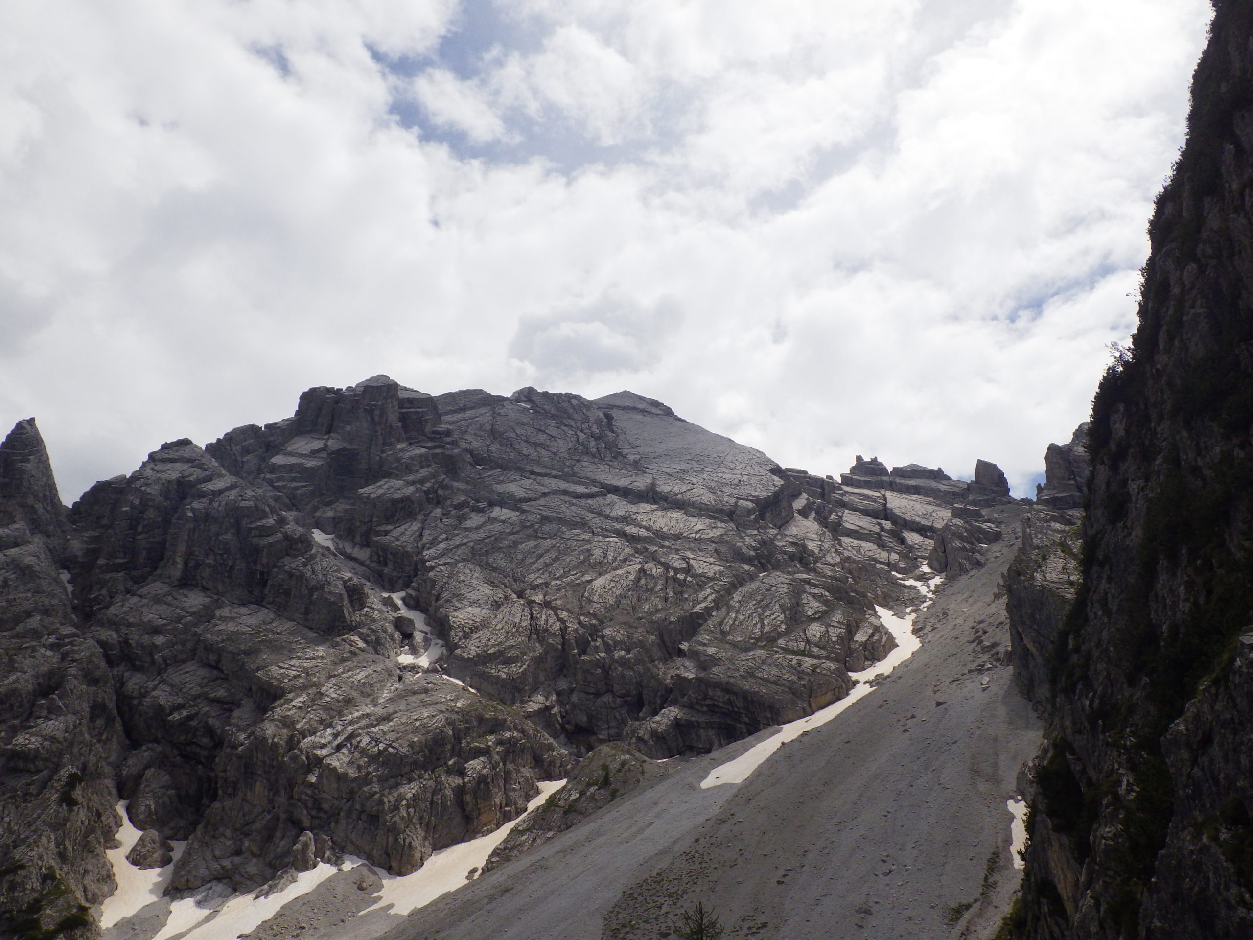
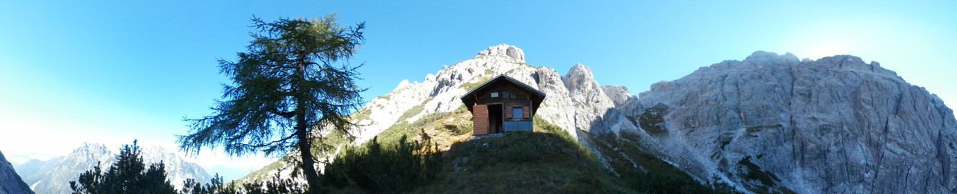
.from the Caimi Bivouac Staying overnight at the Caimi Bivouac, you have to descend the South side of the Group from the Sella del Cornon to an altitude of 1800 m a.s.l. through a fairly dense pine forest (AD 2020), then proceed to gradually climb up to the Forcella Valgrande where, however, there is a deep gully of rocky debris directly below M. Cornon which requires attention in the crossing and forces us to wear the harness for the overpass safely. Once you reach the Forcella Valgrande the route is the same up to the top.
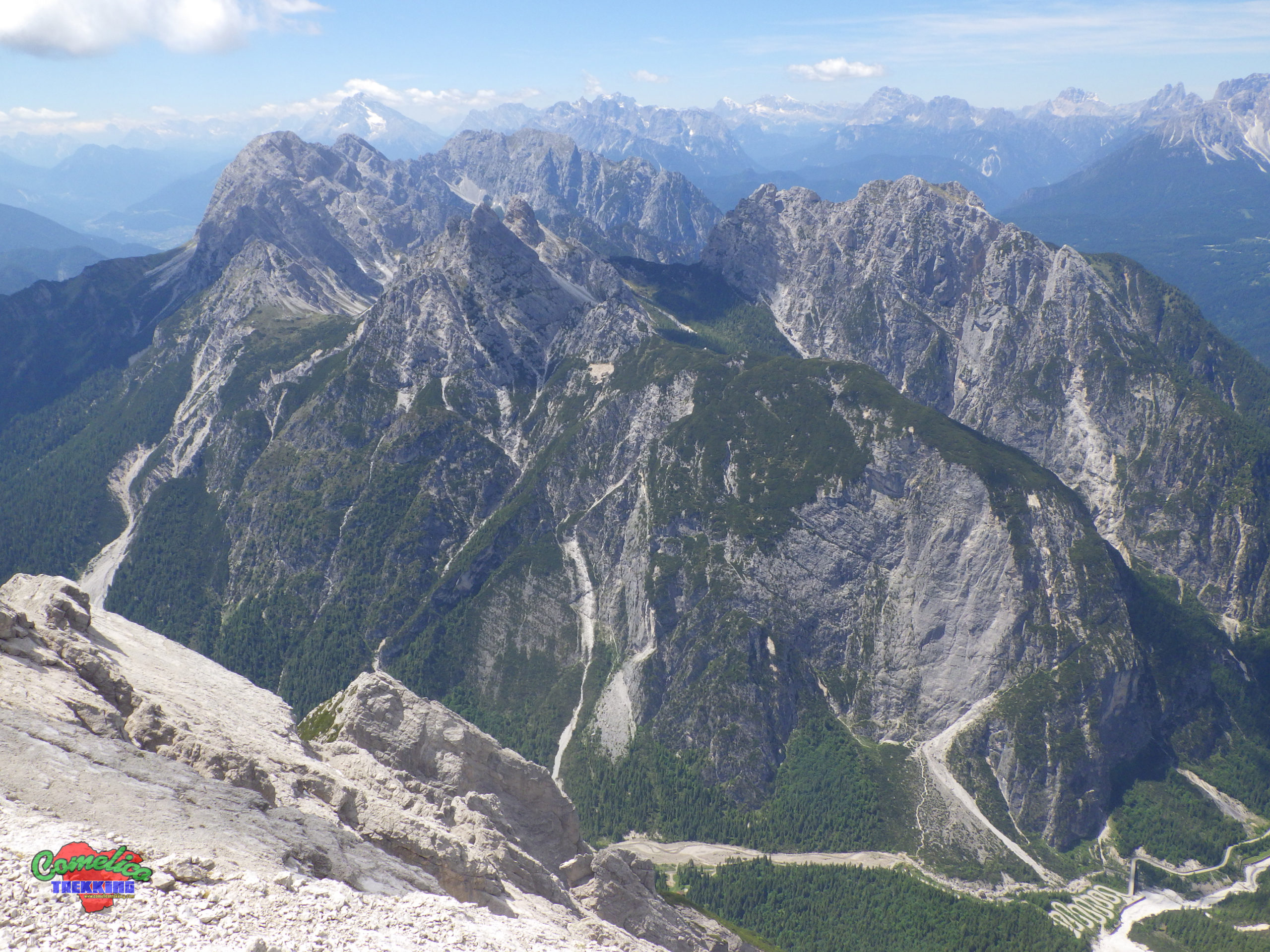
.from Val Piova Choosing instead the approach from the South we arrive by car at the Sella Ciampigotto or from Val Frison, starting in Campolongo and climbing the SR-365 to Forcella Lavardet (Attention Road not always officially open) then deviating to the right on the SP-619, in about half an hour we can load the backpacks on our shoulders, or from Cadore, along the SS-52 to the locality of Tre Ponti and deviating to the left we take the SP-619; after passing the town of Laggio and the suggestive Passo di Ciampigotto, in just over half an hour we are at the lay-by where we can leave the car. From the Passo di Ciampigotto the approach to the mountain is still long, in fact you have to cross two more Forks, the Losco and the Camporosso before starting the climb; the difference in height, however, is almost zero and you proceed through meadows with a suggestive view of Monte Brentoni and beyond. Alternatively, you can leave the car just before climbing the Valico di Cima Ciampigotto, in the locality of Antoia, and take the road that leads to Malga Losco through the woods and from here turn left towards the Forcella Camporosso.
.from Spagnolli Bivouac Spending the night at the Spagnolli Bivouac and then starting at high altitude, we descend a few hairpin bends to the Forcella Stareza and, leaving the boring CAI-330 path that leads to the Cadin Alti, we take the wild and remote CAI-328 path which, with brief losses in altitude, runs underneath Monte Pupera and the Cresta dei Castellati until we reach, with an hour’s ascent, the path that leads to the summit of Monte Brentoni. Be careful this route is not recommended for beginners, as there is a debris drain under Monte Pupera that has swept away the path and is also challenging to climb, therefore a route for experts.
The climb
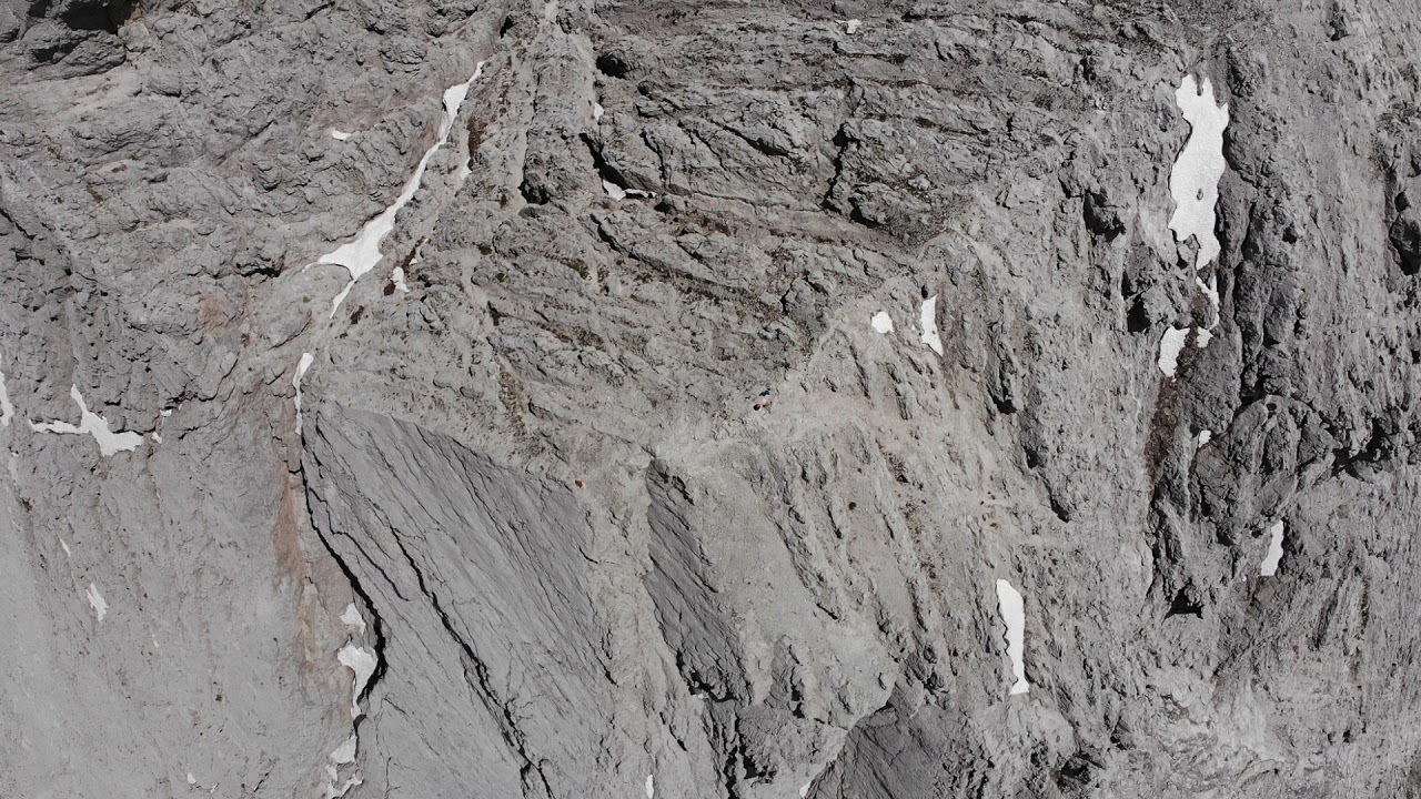
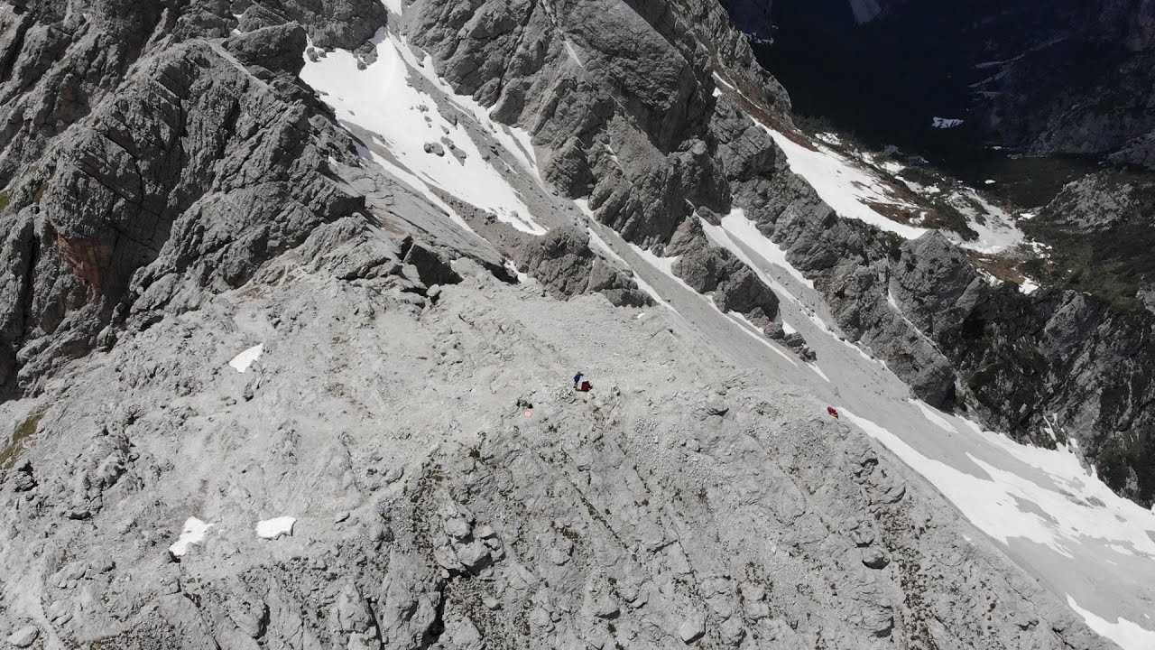
The normal route to the Cima Ovest del Monte Brentoni (2547 m a.s.l.) starts leaving the path marked CAI-328 near the mountain. We climb steeply towards the north, initially on a track hollowed out in the meadows, then the rock accompanies us all around. We turn left around a plastron of compact rock and reach the first metal rope that helps us to pass some solid ridges of good rock. Then cross a scree to the right until you reach a fork that allows you to put on the via ferrata harness. The recently built section winds almost vertically along a large chimney, which is nothing more than a crack between one slab and another, and in half an hour you come out on a scree that leads straight to the West peak.

- 1
- 2
- 3
- 4
- 5