Google Maps – Peak of Mount Terza Media
Excellent autumn climb, summit not for everyone with climbing stretch and various exposed passages at the end. Drone videos have also been added. Peak of Mount Terza Media from Drone
![]()
..dedicated to those who are not and who can no longer go
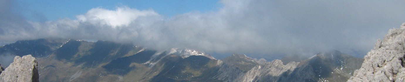

Excellent autumn climb, summit not for everyone with climbing stretch and various exposed passages at the end. Drone videos have also been added. Peak of Mount Terza Media from Drone

First summer release of this 2021 takes me to complete the drone shooting of this beautiful valley and the peak that dominates it. Rocket, Orbit and Pan videos also added. The Little Forks Valley...

Copious update to the mountains overlooking the beautiful Val Vissada. San Daniele New track of the Via Sud with a more scenic route Waipoint of the Ferruccio Casanova equipped path Spherical photo of the...

This time we go to Monte Brentone, the main peak of the homonymous group. Climbed from the not aided via Sud we cut the dihedral to the right until we reach the ridge that...
I return to complete the set to Danta, and pleasantly cross its surroundings again adding two aerial shots. The Torbiere of Danta from Drone Very interesting from the point of view of aquatic flora...

Stunning shots taken by my drone depicting the set of small valleys that form the Comelico valley and some nearby valleys Frison Valley Sesis Valley Ansiei Valley Piova Valley Melin Valley Digon Valley Grande...

First real high altitude excursion for this 2021 season. Departure from Pian delle Bombarde at Baita Rododendro. We first reach the Olbe Lakes which we still find covered with snow, then we climb Mount...

Simple afternoon outing on Mount Spina. Leaving just above Casamazzagno in the locality of Le Federe, we set off towards the north following the CAI-147 signpost. In short we reach the 1967msldm of Mount...

Today sunbathing towards the sources of the Piave. Once in Visdende Valley we leave the car in Sesis and go up to Pass of Caneva Hill by the mule track marked CAI-137, first in...

Today we try a simple and usually not very tiring climb. Starting a little further below Hut of Londo we went up the Londo Valley up to the Palombino Pass at an altitude of...